NEW PRODUCT

Flood Finder

Flood Intelligence Where You Already Work

Flash Flood Intelligence. On Demand. At Scale.
When conditions escalate in minutes, scheduled models fall behind. Most flood modeling tools run on fixed schedules, so decisions get made on incomplete information. Flood Finder closes that gap with AI-powered, basin-level flood intelligence in 5 to 10 minutes, on demand, anywhere in the world. Easily integrate Flood Finder into Esri, custom dashboards, or internal tools through a flexible API.
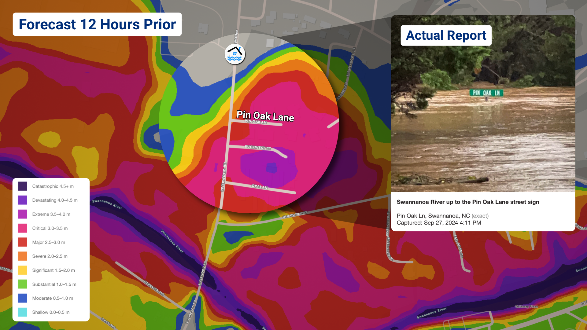
FloodFinder_Helene_PinOakLane

How it Works

STEP 1 Select your basin or area.
STEP 2 Run the model with a push of a button.
STEP 3 Act on street-level guidance in 5 to 10 minutes. Re-run anytime conditions change.
5–10min
for a full model run, on demand
10m
resolution worldwide
10-15min
radar updates
35+yrs
of Baron Weather expertise

See what
floodwater will do.

Flood Finder pairs Baron's high-resolution forecasting with a physics-trained AI model to go beyond flood extent, at the street and basin level, during a live event.

How deep the water gets How fast it moves Which direction it flows

Advanced Flood Intelligence at Your Fingertips

Rapid Results

Results from a full model run in 5 to 10 minutes. Re-run anytime as flood conditions continue to evolve.

High-Resolution

See how deep floodwater gets and where it's headed, as fine as 10 meters, anywhere in the world.

API-Accessible

Trigger a run through a simple API and receive open formats such as GeoTIFF in your existing platforms.

Easy Operation

Getting results is as simple as pushing a button. Select a basin, start a run and act on guidance in minutes.

All-in-One

Everything you need for flash flood awareness, from early warning to impact detail, inside the tools your team already relies on. 
Delivery

The Last Mile Advantage

Baron configures delivery and output around your operations, including integration with ArcGIS platforms. That way, flood intelligence reaches your end users where they need it, inside the tools they already use. 

RUN Flood Finder model run Started on demand or through the API
OUTPUT GeoTIFF or Web Layers  Open formats or widgets configured by Baron for your team
YOUR SYSTEMS Where your users already work Internal decision-support system, customer-facing app or field operations platform
Who it's for

Built for Your Industry

Every team that needs to know where flooding will hit, and how bad it will be, before it happens.

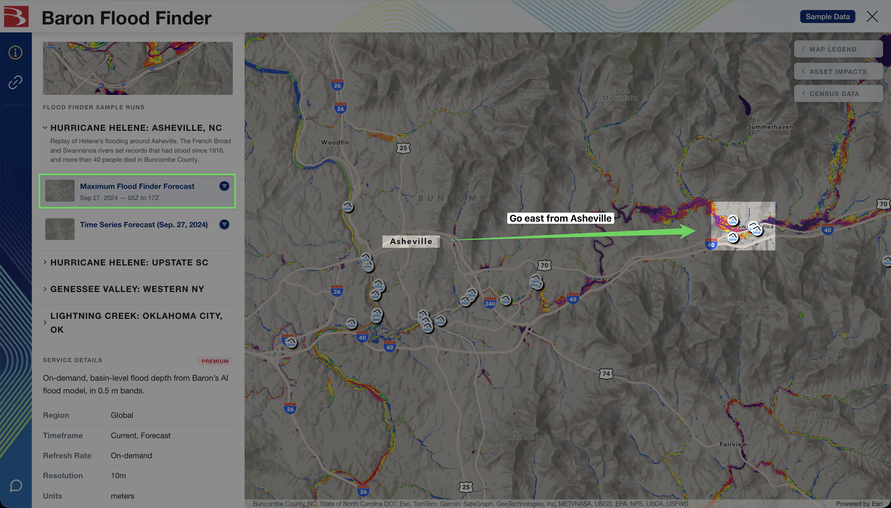
Asheville Helene Data Discovery
FloodFinder_Helene_PinOakLane
01

Emergency Management

When a flash flood warning decision has a five-minute window, forecasters can't wait on the next scheduled model run. Flood Finder delivers basin-level guidance minutes after a run, enabling faster warning decisions and more coordinated response.

02

Utilities and Energy

Flood damage to grid infrastructure and field crews often outpaces legacy tools. Flood Finder's high-resolution output lets operators identify at-risk assets before conditions deteriorate, reducing outage risk and improving crew safety.

03

Transportation and Infrastructure

Road closures, rail disruptions, and bridge failures often follow flash flood events with little warning. Flood Finder gives operators precise, ahead-of-the-event intelligence to reroute and respond before conditions deteriorate.

04

Government and National Hydrology Agencies

Many regions lack the ground sensor networks traditional flood modeling depends on. Flood Finder deploys wherever terrain data exists, complementing existing forecast operations, especially where ground sensor coverage is limited.

05

Insurance and Risk

Coarse spatial resolution has long limited operational flood assessment. Flood Finder's 10-meter output gives insurers and risk modelers a level of localized detail not previously available from operational flood modeling.

Proof

Real-World Flood Verification

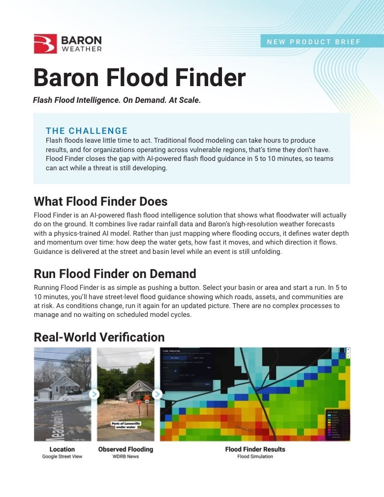
See how Flood Finder’s guidance lines up with real flooding, from the location before the event, to observed flooding, to the model’s own output.  

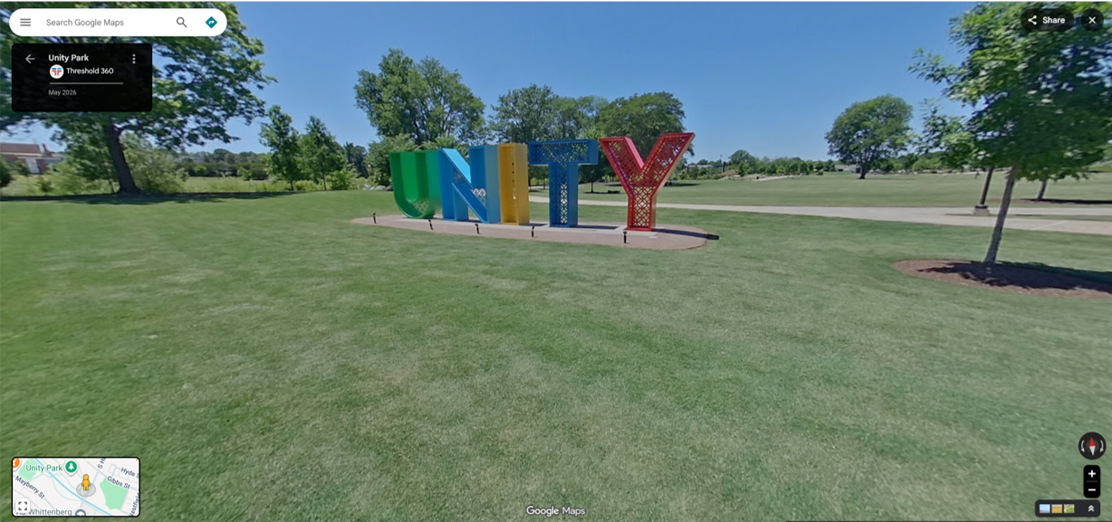
Helene Greenville Google Street View Vanzeppelin Aerial YouTube-1

Location: Greenville, SC (Google Street View)
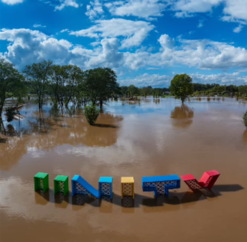
Helene Greenville Google Street View Vanzeppelin Aerial YouTube water-1

Observed flooding: Photo: Vanzeppelin Aerial
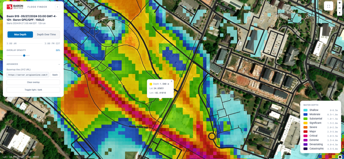
Flood Finder results: Modeled maximum depth: 1.54 m (5.0 ft)
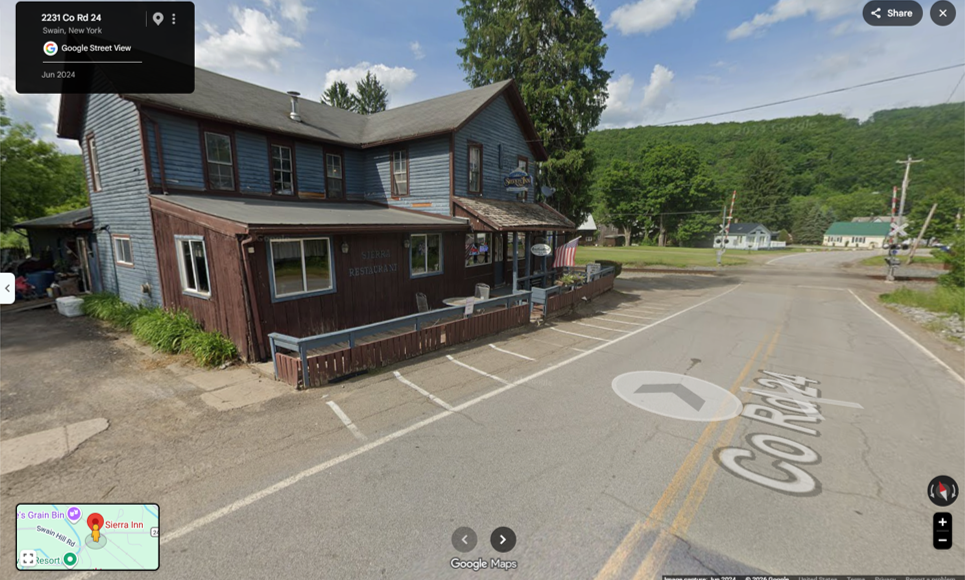
Google Street View of the Sierra Inn in Swain, NY

Location: Swain, NY (Google Street View)
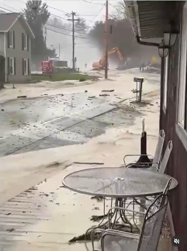
Sierra Inn Flooding - Instagram: snitileric

Observed flooding: Video still: @snitileric
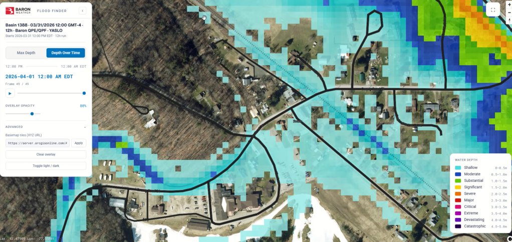
Flood Finder results: Modeled maximum depth: 2.88 m (9.4 ft)
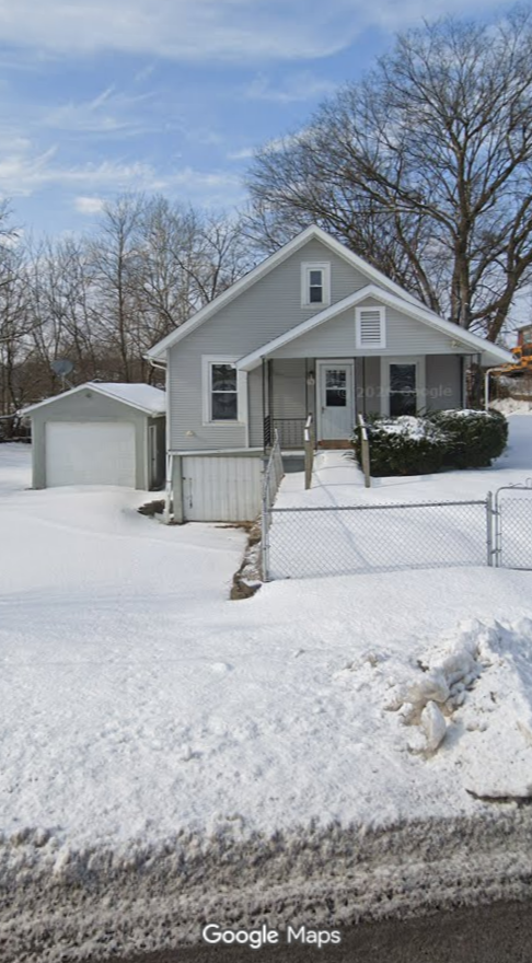
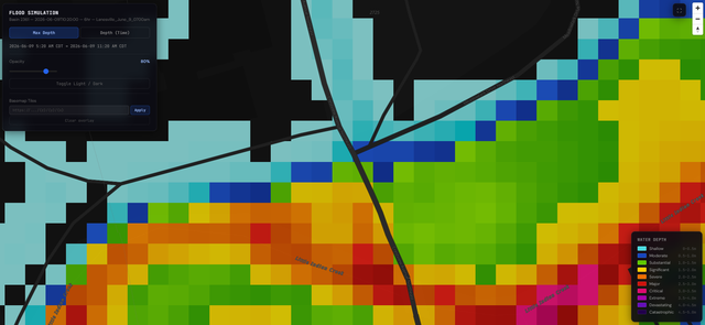
Lanesville, IN home Flooding

Location: Lanesville, IN (Google Street View)
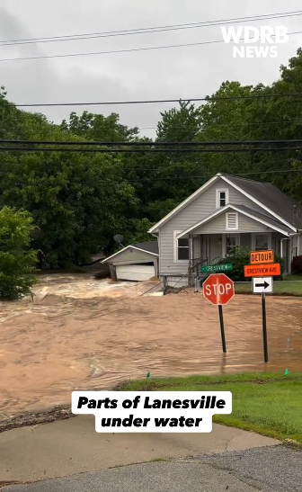
Lanesville, IN home flooding WDRB News

Observed flooding: WDRB News

Flood Finder results: Flood simulation

Backed by Baron

Baron Weather brings decades of expertise in radar, numerical weather prediction, and meteorological science, and Flood Finder delivers it straight into the systems you already use. From ArcGIS to in-house platforms, Baron handles the full stack, from data ingestion to model output to delivery. No new interfaces. Just flood intelligence, right where your team works. 
Frequently Asked Questions

How the model works, how it compares, where it runs, and what you need to get started.

What is Flood Finder?

Flood Finder is Baron's AI-powered flash flood intelligence solution. It combines high-resolution weather forecasting with a physics-trained AI model to show what floodwater will actually do on the ground: how deep it gets, how fast it moves and which direction it flows. Results are ready in 5 to 10 minutes, on demand.

What industries use Flood Finder?

Flood Finder supports any organization that needs to know where flooding will hit and how severe it will be. That includes emergency management, utilities and energy, transportation and infrastructure, government and national hydrology agencies, and insurance and risk modeling. Output is delivered in open formats that fit into the systems each team already uses. 

Do we need our own radar or weather infrastructure?

No. Flood Finder runs on Baron's high-resolution weather forecasts, so you don't need your own radar, sensors or forecast models to get started. If you already have radar coverage, Flood Finder can use it to add observed rainfall and sharpen results. 

How do we get Flood Finder into our own systems?

Flood Finder is built for enterprise integration from the start. Trigger a model run and receive GeoTIFF output via API, and Baron works with your team to configure delivery so it fits your existing platforms, dashboards, or field operations tools.

Is Flood Finder suitable internationally?

Yes. Flood Finder deploys wherever terrain data exists, adapting to regional flood patterns and local hydrological conditions, making it a fit for organizations operating across multiple countries and continents.