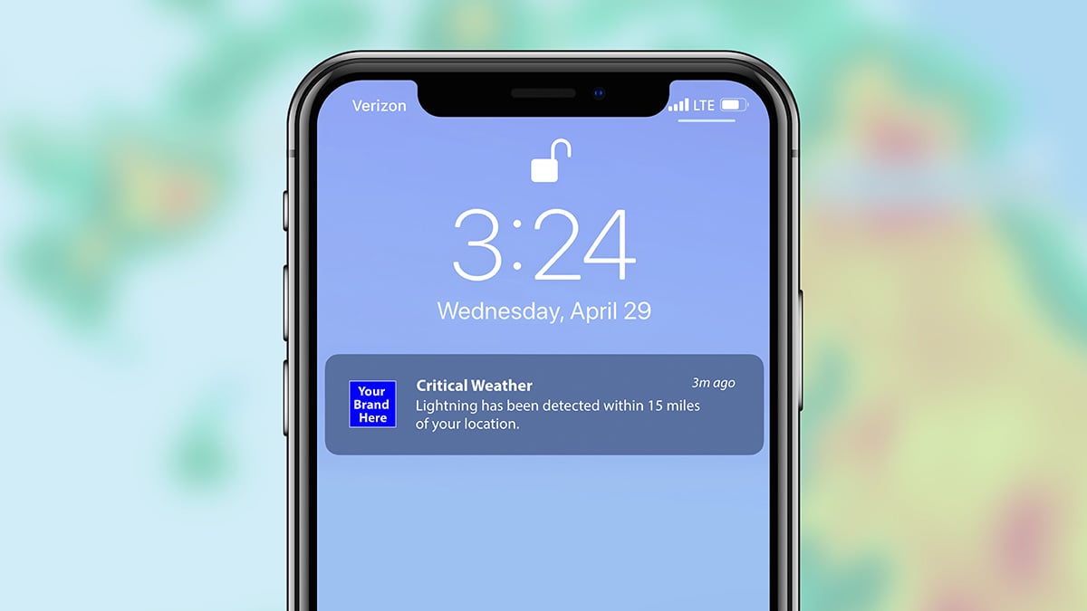
Advanced Alerting
Baron offers advanced alerting solutions designed to provide unparalleled protection and peace of mind. Our technology delivers accurate, location-specific weather alerts, including National Weather Service-issued watches and warnings, and exclusive Baron pinpoint alerting for dangerous storms and twisting winds.
With hyperlocal alerts integrated into your products or accessible via our software platforms, you'll stay informed about a wide range of weather parameters, from flash flooding to tornadoes.
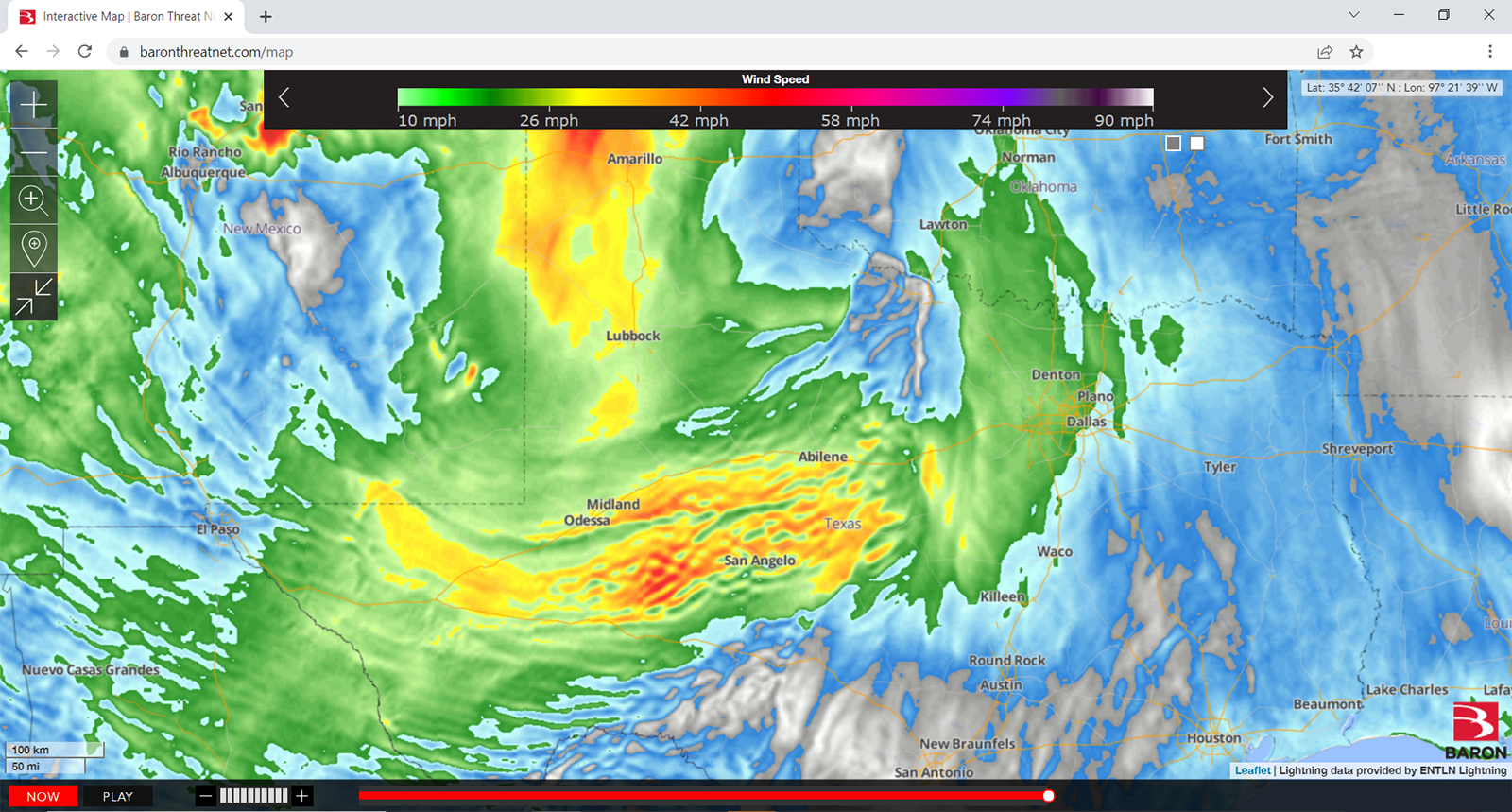
Pioneering storm tracking technology since the mid-90s, Baron continues to lead in identifying specific weather hazards, ensuring you're prepared and protected when it matters most. Trust Baron to keep you ahead of the weather and confidently make mission-critical decisions.


/Esri_2023.png)
/API_AdobeStock_718068621_1600.jpeg)