Flash flooding is one of the top weather-related killers in the world. And with so many variables to consider when assessing this risk, alerting at the right time and place isn’t easy.

Baron developed a newly derived real-time risk dataset that can provide accurate and advanced notice down to a street level where a life-threatening event is likely to occur.
Birmingham, AL, is no stranger to flash floods. There were two fatal events in the city only six months apart in 2022. One of them on March 16 turned streets into rivers within minutes across the Five Points district, catching many by surprise.
#Flooding video from Alabama Wednesday. Heavy rainfall swept through the region, prompting a flood warning in Birmingham. #ALwx #FlashFlood
Get your forecast here: https://t.co/1zY4CFICnm pic.twitter.com/z4sA92Y1GI— WeatherNation (@WeatherNation) March 17, 2022
The flooding prompted at least 8 water rescues near the University of Alabama Birmingham (UAB) campus. Community leaders called this rain event “unusual,” as it hit areas that don’t typically have a flooding problem.
Flash flooding kills an estimated 5,000 people globally per year. The World Meteorological Organization (WMO) and the National Weather Service (NWS) have strengthened forecast guidance on the phenomenon since 2017.
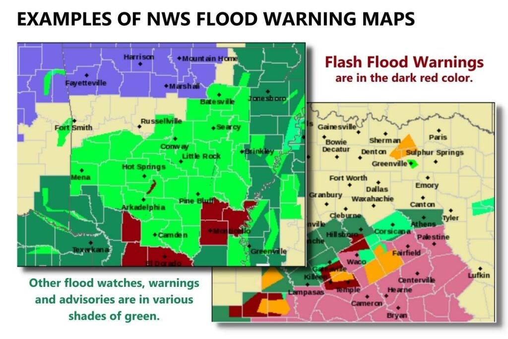
The NWS has had various flood warning products for several decades, all with a unique purpose. However, during a significant widespread rainfall event, the map can get complicated, making it challenging to understand where and when the flooding is life-threatening.
In 2019, the NWS even began restricting Wireless Emergency Alerts (WEA) for flash flooding to “lessen the perception” of over-alerting.
Baron’s new flash flood product makes assessing this risk simple and precise. This video delves further:
The guidance shows the threat of flash flooding over the next two hours with a superficial three-tiered risk level: Elevated, high, or very high. The model uses a high-resolution 23-year-long historical dataset of soil-moisture evolution and runoff, then matches it with recent rainfall rates and short-term modeling to pinpoint where an extreme event is likely.
During the Birmingham event on March 16, Baron’s Flash Flood Risk map showed a “high” chance of flash flooding in the Five Points district 44 minutes before the National Weather Service issued a Flash Flood Warning (2:44 pm CDT). The WEA alert (prompted by an update with “life-threatening” verbiage) reached mobile phone users at 2:54 pm CDT.
Preparing for a sudden weather emergency, such as a flash flood, requires a multi-faceted approach. Baron Weather provides superior data that cuts through the noise when critical decisions must be made quickly.
The new Flash Flood Risk guidance dataset is available to developers in the Baron API or by the Baron Threat Net web application emergency response personnel.
