Choosing the right tools makes all the difference when doing any project or task. Insurance professionals have leveraged weather data for years when making wide-ranging decisions, from underwriting risks, insurance premiums, risk management, and claims validation, just to name a few.
Weather data is more critical today than ever for several reasons, including climate change awareness, advancements and reliance upon geospatial imagery, and insurance carriers’ ability to augment historical data with real-time information. Making weather decisions also calls for using the right tools for the specific project because accuracy matters.
The word “accuracy” is often paired with weather forecasting, but not all weather data is the same. Baron has deep meteorological knowledge and talent with a large staff of meteorologists. Baron also knows weather from decades of installing radar systems, collecting and storing weather data, and superior weather visualization tools widely used by media across the US.
Weather Forecast Data
Baron’s weather forecast service shows the weather down to the specific street and address, so you know precisely how homes and business properties may be affected and when the bad weather will hit. You can access historical weather data with the Baron Weather Archive to better understand how weather events have impacted a location over time. This allows you to assess risk more accurately. With Baron’s Weather Archive, you’ll be able to understand the effects of weather on properties better, implement protections ahead of time, produce financial loss projection scenarios, and prepare response resources more efficiently.
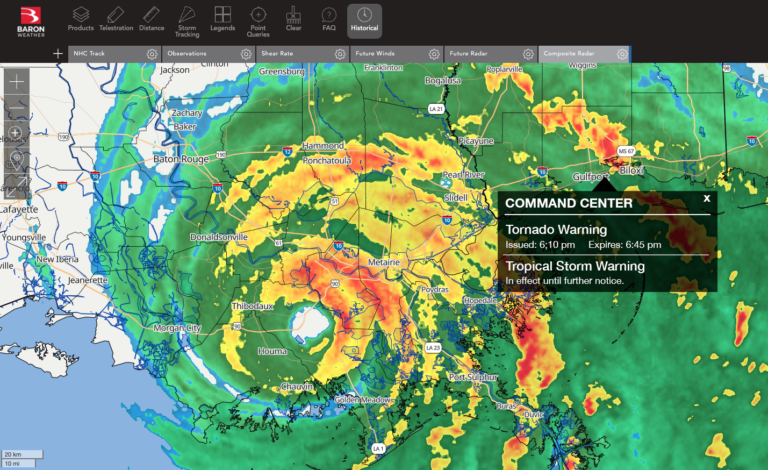
When a severe weather event is approaching, decision-makers must have the correct data to make the best decisions. Baron provides access to robust and tropical weather data, enabling them to accurately predict and project the path and intensity of these events to allow teams to be prepared. Unique Baron products such as the Baron Shear Detection and Baron Hurricane Index provide advanced warning and location specificity to weather observations. With this knowledge, response teams can prepare for potential dangers and limit damage. With Baron’s weather companies can accurately evaluate the risk for properties before, during and after weather impacts.
Weather Inspector
The Weather Inspector is an innovative tool that provides companies with weather information for specific locations and date ranges, allowing insurance companies to score properties easily and quickly and validate claims. Companies can look at how the weather affects their business by accessing advanced insights and observing how weather affects KPIs.
Threat Net
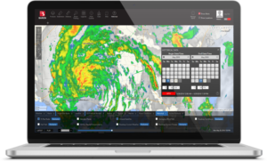
Baron Threat Net is essential for active monitoring and advanced preparation for all weather hazards. The solution incorporates three easy ways to track inclement weather. The web portal is a fully-featured weather monitoring system that provides street-level views and can layer numerous data products. It also offers simple custom alerts that track weather for locations you define and alert you on screen via email or push notifications to your phone. Plus, our companion app allows you access to real-time weather wherever you go.
Easy-to-Use Weather Data for All Platforms
Baron Weather’s weather API, GIS, and Web and mobile apps are an easy-to-digest catalog of all the weather worldwide, so you’ll have all the data you need to make decisions at your fingertips, no matter where claims were filed. Our data integration is easy, flexible, and scalable. Baron’s weather data empowers your business through accurate, timely information, allowing you to analyze data and make informed claims decisions.
If you want to mitigate risk and be prepared for all types of weather, partner with Baron for your weather solutions needs.
