Decisions require details when a hurricane approaches. And consistency is critical as the clock counts down to landfall.
Florida has been hit by two rapidly developing major hurricanes in back-to-back years. Hurricanes Ian and Idalia were well-forecasted on a regional scale, but precision and run-to-run consistency were lacking in most global forecast models.
The exclusive Baron model came within a county of landfall and one category in strength on nearly all runs once both storms were within the geographic domain of the model.
Baron Model Proofs of Performance
The details surrounding both Ian and Idalia's projected landfall were critical to formulating an effective response plan. The hurricanes rapidly intensified within 36 hours of landfall and were capable of catastrophic damage when their eyewalls came ashore.
The animations below represent snapshots of successive runs of the model leading up to the landfalls of both Hurricane Ian (left) and Idalia (right). They begin when the storm enters the domain of the model, with the actual track (white line) and official NHC forecast tracks (black line) displayed for reference.


The Baron model accurately projected Hurricane Ian to move more east than north as compared to many other global forecast models and the official forecast track. In contrast with Idalia, the model accurately honed in a Taylor County landfall as global models went back and forth between Appalachia Bay and the Nature Coast.
Both "I" Storms Had Unique Eye Movement
Official track and intensity forecasts from the National Hurricane Center have steadily improved over the past two decades. Hurricanes Ian and Idalia came ashore within their respective cones of uncertainty drawn more than four days before. And much has been made -- rightfully so -- of not using the "cone" explicitly for predicting impacts.
However, the oblique approach of both Ian and Idalia's eye walls to the Florida coastline was an important detail. A slight wobble could have been the difference between widespread destruction versus minimal damage in heavily populated areas.
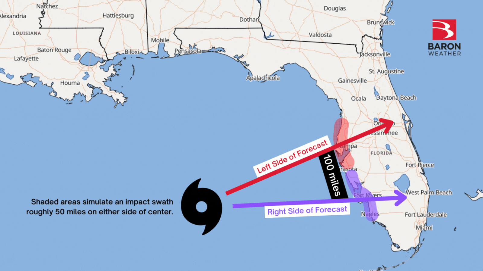
It has been quite the emotional roller coaster for Tampa Bay residents and business owners preparing for both hurricanes. Hurricane Ian, for example, could have caused catastrophic wind and surge damage if the eye was on a trajectory just 40 degrees left (more north) of where it eventually was aimed. Conversely, 40 degrees to the right (more east) with Idalia could have tripled the expected surge in and around the Tampa metro. That's a difference so small it wouldn't even require signage for a similar curve on a road.
Preliminary Analysis of Hurricane Idalia
Note: The Hurricane Ian analysis is available as an ArcGIS StoryMap here.
Hurricane Idalia began as a broad area of low pressure under surveillance in the western Caribbean on Aug. 23. A tropical depression formed in the Yucatan Channel Aug. 26, which then became a hurricane three days later north of Cuba. Rapid intensification ensued over the near-record warm waters of the eastern Gulf of Mexico, and Idalia briefly reached category 4 status just 12 hours before landfall.
Winds Likely Weakened Upon Landfall
Satellite and radar data suggested Idalia was beginning an eyewall replacement cycle (ERC) as it came ashore, which likely reduced its wind and surge impacts along Florida's Nature Coast. An ERC is a natural phenomenon that is difficult to predict and can lead to significant fluctuations in a hurricane's intensity. Preliminary observations and analysis of the Baron composite wind data reveal a sharp decline in maximum sustained speeds over land.
The interactive map above includes the NHC's best track wind radii compared to a derived dataset from Baron GIS analyst Emily Dobbs. Maximum values were processed from real-time data along Idalia's path that account for sensor observations and radar velocities.
The highest derived wind speeds were over Apalachee Bay, whereas the highest reported gusts over land were in Taylor, Madison, and Suwannee Counties.
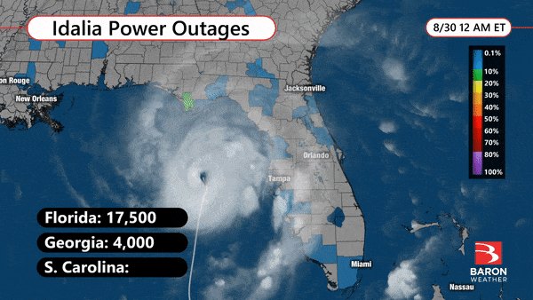
Power outages were widespread were the strongest winds were observed. Gusts over 100 mph peeled off roofs, snapped trees, and knocked down power poles. Nearly all utility customers were without power during the height of the storm in Madison, Taylor, and Suwannee counties.
Heaviest Rain Fell Northwest of Track
A cold front was approaching the Southeast as Hurricane Idalia moved inland. This caused the storm to begin transitioning into an extratropical mid-latitude low. During this process, the forcing and lifting mechanisms that produce persistent heavy rain rotated to the northwest side of the storm's track. This was evident in an analysis of both rainfall reports and derived radar estimates.
The interactive map below includes a collection of official reports, reporting stations, and the estimated 72-hour rainfall from credible radar data. You can use the slider to reveal the Baron model forecast (below the slider) from the Monday evening run, which was approximately 36 hours before landfall.
Above Slider: Exclusive Baron 72-hour rainfall composite analysis for the duration of the event.
Below slider: Exclusive Baron model precipitation forecast from 7 pm Monday August 28, a full 36 hours prior to landfall.
Unlike the winds, the heaviest rain from Idalia fell well inland. Flash flooding was reported from southeast Georgia through coastal South and North Carolina. Some river flooding also occurred in the days following the storm, although this was mitigated by Idalia's faster forward motion as the storm weakened.
Data shared on this page is available for your own ArcGIS applications or digital products via the Baron API. Baron also provides visualization platforms and builds radars for media and government agencies across the globe. We have experts standing by to help!
