Flash flood events in Tennessee and Virginia - both on the same night last week - resulted in numerous water rescues, washed-out roads, evacuation orders, damaged homes, and even a search and rescue operation1.Flash flood warnings were issued as the event unfolded. High-resolution modeling from Baron also provided more than an hour's notice ahead of the warnings that a significant event was about to occur.
The Flash Flood Setups
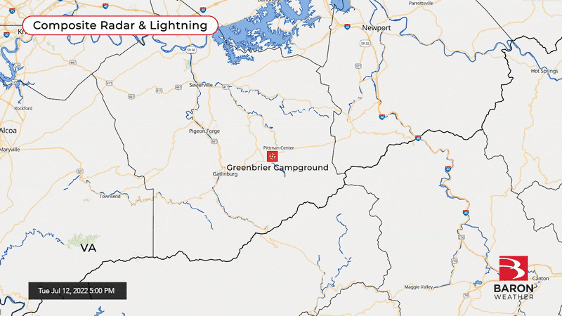
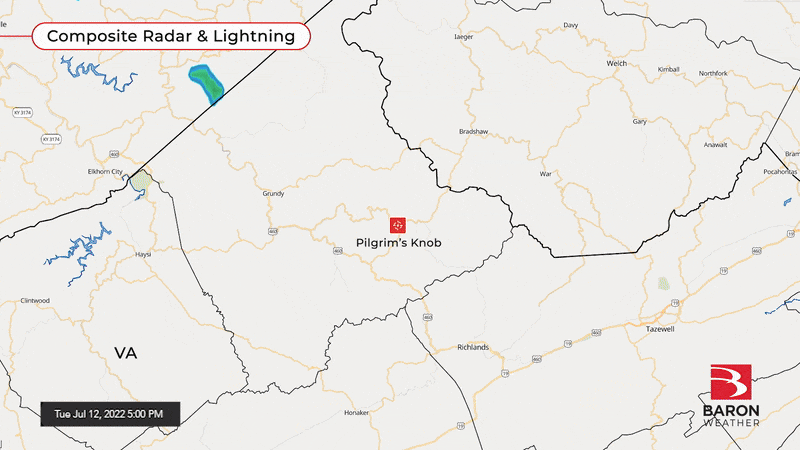
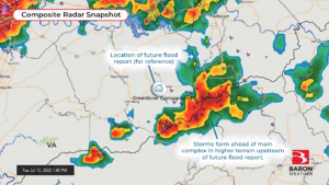
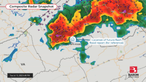
Both flash flood events occurred from the same large-scale weather system - a slow-moving front, and they had a lot in common. A thunderstorm complex with multiple downpours moved over mountainous terrain across a common watershed, resulting in rapid runoff into creeks and streams through a valley community. The most affected areas by these events were near the towns of Gatlinburg, TN and Pilgrims Knob, VA.
Gatlinburg, TN Pilgrim's Knob, VA Gatlinburg, TN
Pilgrim's Knob, VA
The variables that lead to a flash flood event are always unique, and these have their differences, too. The flooding in eastern Tennessee was likely exacerbated by heavy rainfall ahead of the main storm complex, possibly aided by additional lift in the atmosphere from the Smokey Mountains. The storm cells in southwestern Virginia were training (repeating) over the same areas for more than four hours.
Timeline of Modeling and Alerts
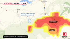
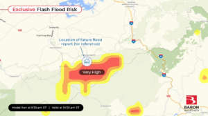
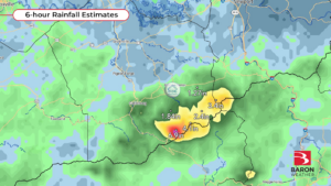
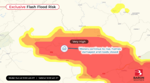
The right combination of automated alerts and expert analysis is key to mitigating or preventing weather disasters. The timeline of alerts and data below showcase the advancements that have been made in flash flood modeling by Baron Weather. These very complex weather scenarios were [simplified] into a derived 3-level risk map to pinpoint where the extreme events were likely to occur.
Eastern Tennessee Event
8:40 pm ET 9:00 pm ET 9:30 pm ET 10:00 pm ET 11:14 pm 11:16 pm ET 2:30 am ET
Rain begins to fall
1st Baron model run
2nd Baron model run
3rd Baron model run
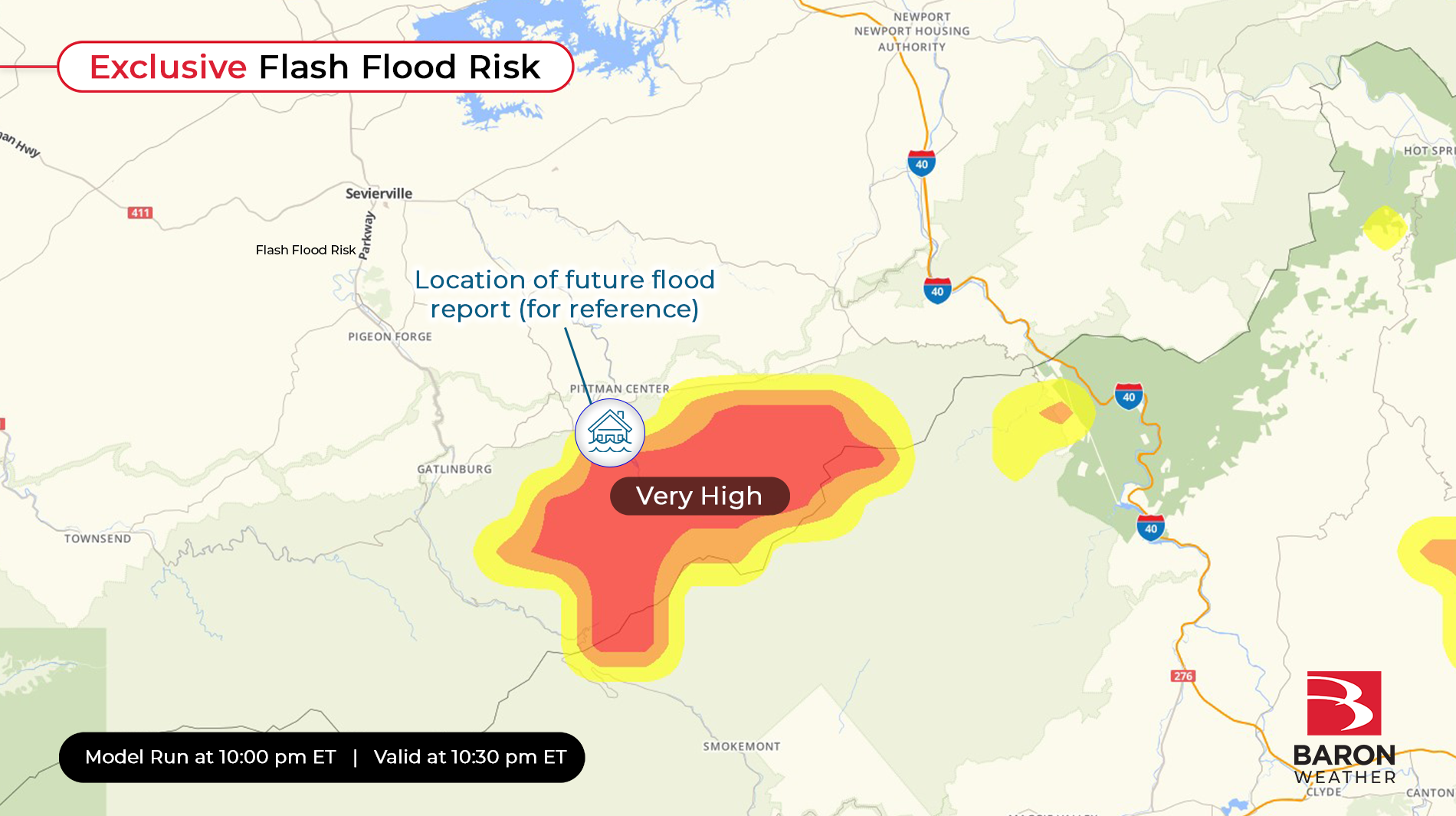
Flash flooding reported
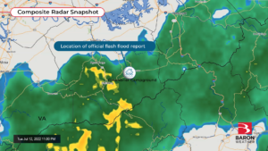

Flash Flood Warning
Rainfall totals
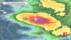
Western Virginia Event
6:40 pm ET 7:30 pm ET 8:30 pm ET 8:33 pm ET 9:30 pm ET 10:00 pm ET 1:00 am ET
Rain begins to fall
Flood reports
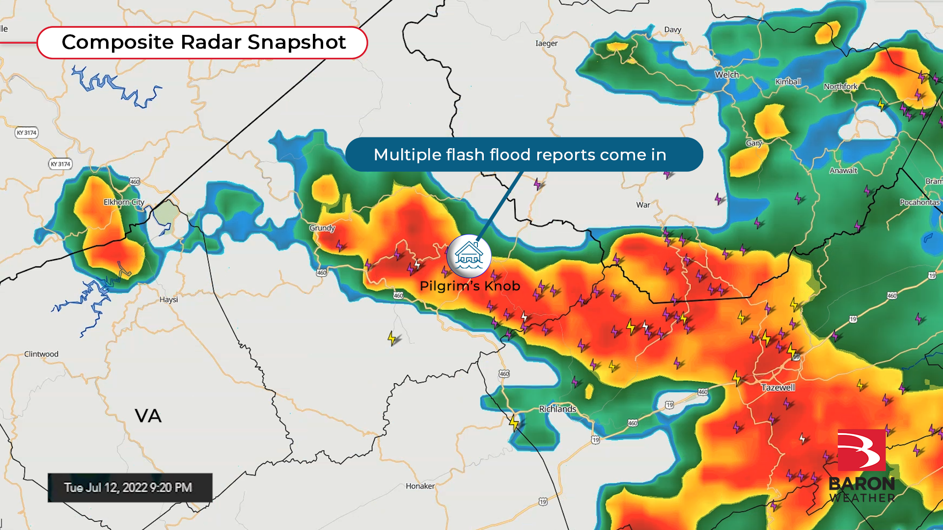 Multiple reports of flash flooding come in from Buchannon County, including the news over 100 homes were inundated and 40 people were unaccounted for near Pilgrim's Knob.
Flood risk continues
Rainfall totals
Preparing for a sudden weather emergency, such as a flash flood, requires a multi-faceted approach. Baron Weather provides superior data that cuts through the noise when critical decisions need to be made fast.
The Flash Flood Risk guidance referenced in this story is available to developers in the Baron API or for use by emergency response personnel in the Baron Threat Net web application.
1 Crews still searching for 3 people after Virginia flooding | AP News
