This winter had it all: historic snowfall, flooding rains, crippling ice storms, a deadly blizzard, and destructive tornadoes.
Winter weather can be challenging to predict and plan for. Each event can be unique and present its own set of challenges. But with more intelligent data and reliable modeling, you can make better decisions that save time and money.
Top Events of 2022-2023 Winter
The 2022-2023 winter season has been one of haves and have-nots. Historic snow buried Buffalo, atmospheric rivers flooded the West Coast, and tricky ice and snow storms have blitzed the South.
Meanwhile, much of the Northeast and Mid-Atlantic are amid a snow drought, and nearly half the nation has experienced warmer-than-normal temperatures.
As extreme events become more common in our ever-changing climate, you'll need more than the everyday weather app to make critical decisions. Several winter weather events this year have highlighted the need for a more innovative approach to your decision-making, which we will recap below.
Historic Snow Hits Buffalo Area. Twice!
The National Weather Service called the first snowstorm an "epic event." It lasted three days and dumped over 80 inches of snow on Hamburg, NY (just outside of Buffalo) from Nov. 17 to 20, 2022.
Here is a three-day visualization of the persistent snow bands moving off Lake Huron.
Two-day snowfall records were set in Erie and Genesee counties, where 3 to 4 feet of snow was commonly reported.
Another historic storm hit the same region just over a month later. A blizzard blasted the Buffalo metro area on Dec. 23-24, with lake-effect snow continuing through Christmas. The storm produced wind gusts to hurricane force for more than 24 hours, causing widespread power outages, shutting down roads and airports for three days, and claiming 47 lives. A new daily snowfall record was set at the Buffalo Airport at 22.3 inches on Dec. 23.
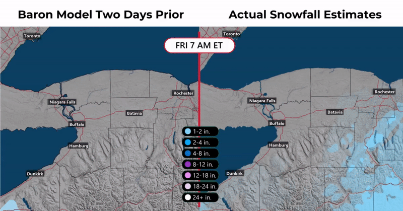
Extreme events like these were no match for the exclusive Baron forecast model. The movie above compares the model run two days before the event with a post-storm analysis of snowfall amounts.
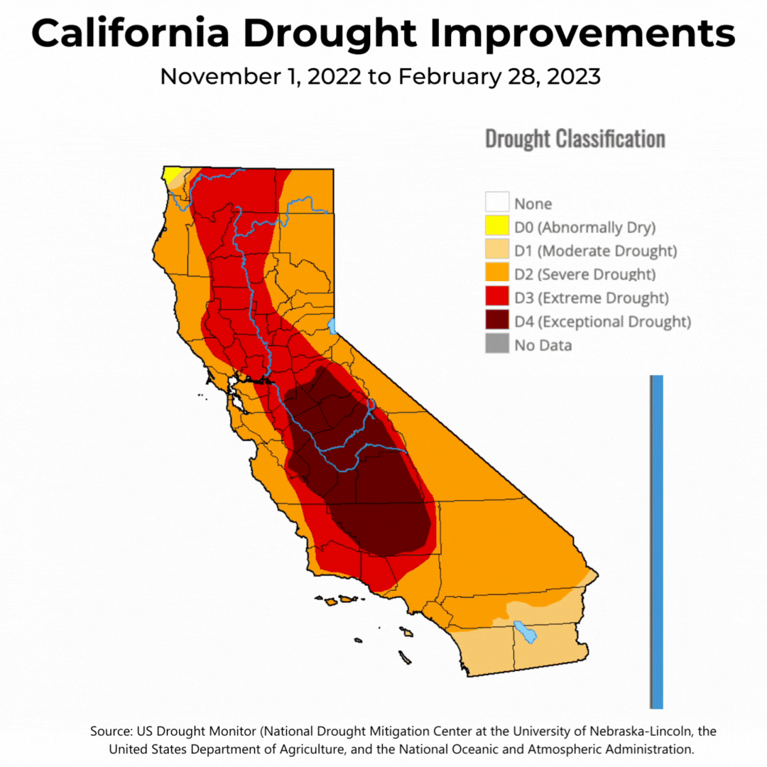
Atmospheric Rivers Erase Most of California's Drought
More than 600 inches of snow fell this winter across California's highest peaks of the Sierra Nevada mountains. Feet of rain also drenched the lower elevations of the Golden State, resulting in dramatic improvements to the state's multi-year extreme drought.
A repetitive upper-level pattern steered tropical moisture into the West Coast through atmospheric river events.
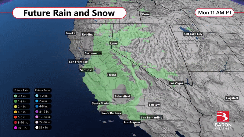
Each storm system targeted different sections of the state, and the exclusive Baron future rain and snow models tracked this variance with great detail. Notice the incredible differences in precipitation types and amounts forecast between valleys and mountain ranges.
Heavy Snow in the Smoky Mountains
The Smoky Mountains often receive more snow than their lower-elevation neighbors during winter. An extreme event dumped over two feet on the eastern Tennessee hilltops in mid-January.
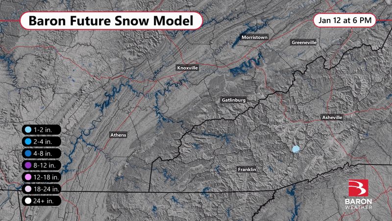
Even though the event wasn't widespread and essentially didn't affect populated areas, it was comforting and fascinating to see how resolute the Baron forecast model was at the hyperlocal level.
Multiple Messy Mixed-Precipitation Events Across Central U.S.
The winter will be remembered by many in the South and Southeast for the absence of cold air. A heavy snow event failed to reach its accumulation potential multiple times across the Southern Plains and Ozarks because ground and air temperatures were just above freezing.
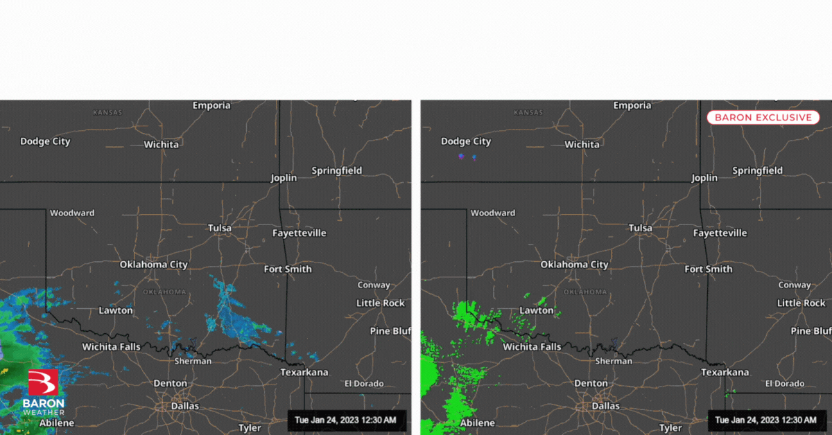
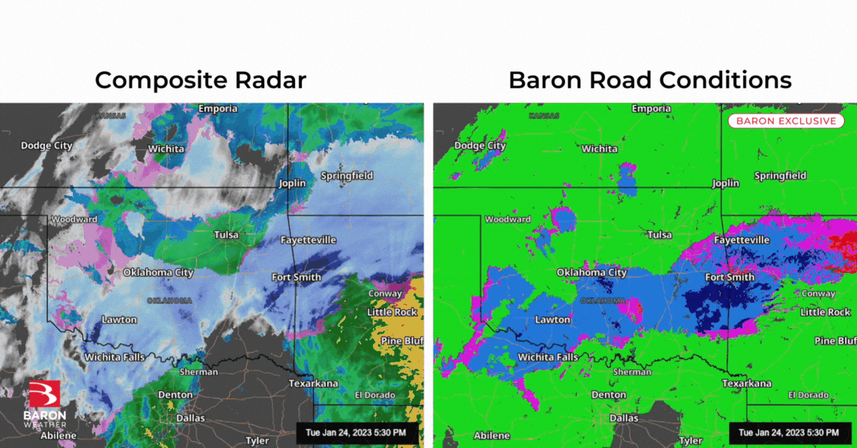
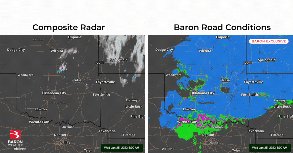
When heavy snowfalls for hours but doesn't accumulate on roads, many businesses may make a costly decision to delay or cancel travel unnecessarily. Pairing a credible precipitation forecast model with one that offers deeper insights on pavement temperatures is key to assessing potential impacts to your operations.
Ice Storm Snarls Travel
A multi-day freezing rain and sleet storm brought travel to a standstill from Texas to Tennessee as the calendar flipped from January to February. This was a complex event to prepare from a communication standpoint because of several prior winter weather events that didn't impact roads.
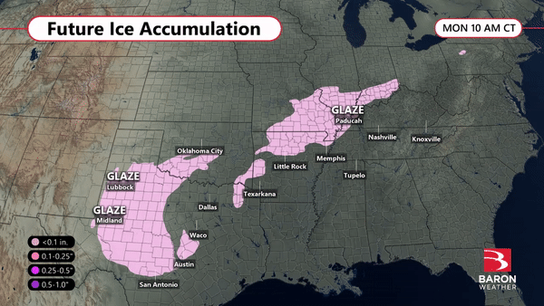
The timing and depth of the cold air is key to determining how much freezing rain or sleet is able to accumulate on roads. Thankfully, this was accounted for in the Baron model that accurately projected ice accumulation (freezing rain).
Multiple severe weather outbreaks hit the Mid-South and Deep South over the winter season. A persistent warmer-than-average weather pattern led to some powerful tornadoes, including one that hit Selma, AL on January 12 that claimed nine lives.
A Baron from Alabama Power, Critical Weather Institute captured the tornado moments before tragically hitting the city.
According to preliminary data from the National Weather Service, there have been 313 reports of tornadoes this winter across the U.S. This is more than three times the 30-year average for the same period, and 70 of the tornado reports occurred on January 12.
Even though the meteorological winter (Dec-Feb) has come to an end, wintry precipitation can impact your operations for weeks and months to come. Baron's superior data is designed to improve the efficacy of your response by giving you confidence in when to make those difficult decisions.
We've given you several examples of how Baron technology could benefit your organization. Let us know if you want to talk to an expert and discuss how our weather data can help you make better winter weather decisions.
