Flying may be safer than driving, but weather hazards thousands of feet in the air have more significant consequences. Therefore, superior weather data is crucial to flight planning and tracking.
The naked eye can only see a two-dimensional rendering of objects in the sky, some of which could be light years away. A pilot or air traffic controller must account for millions of data points from takeoff to touchdown in horizontal and vertical spaces and over time. Simply put, raw data sets won’t cut it.
There’s no room for error in flight planning. When you choose a weather vendor, the data sets must be matched to a specific decision-making process. This requires complex algorithms under the hood to make all the moving parts simple to understand.
Christy Bechtel is a meteorologist who specializes in-flight weather. When she talks to aviation professionals about their data display systems, she discovers they all have a unique focus.
“Whether it’s an airport, an airline, or even private pilots, it’s not a ‘one size fits all’ situation. There is so much weather data out there, so I aim to match specific products to their needs,” Christy says.
Uptime is also crucial to a successful data package. Midflight is not the time for a delay.
“It’s important to know what application is using the data, what their means of transmission is, and then make sure they are getting exactly what they need within that bandwidth,” she adds.
The following suggestions can take your weather data to new heights.
Choose a Cross-Section Over Maps
It’s impossible to see all relevant weather data at multiple levels of the atmosphere on one map. Choose a display system that can accommodate the change in altitude and time throughout the flight. You then want to select a product that merges datasets and flight paths to produce a cross-sectional view.
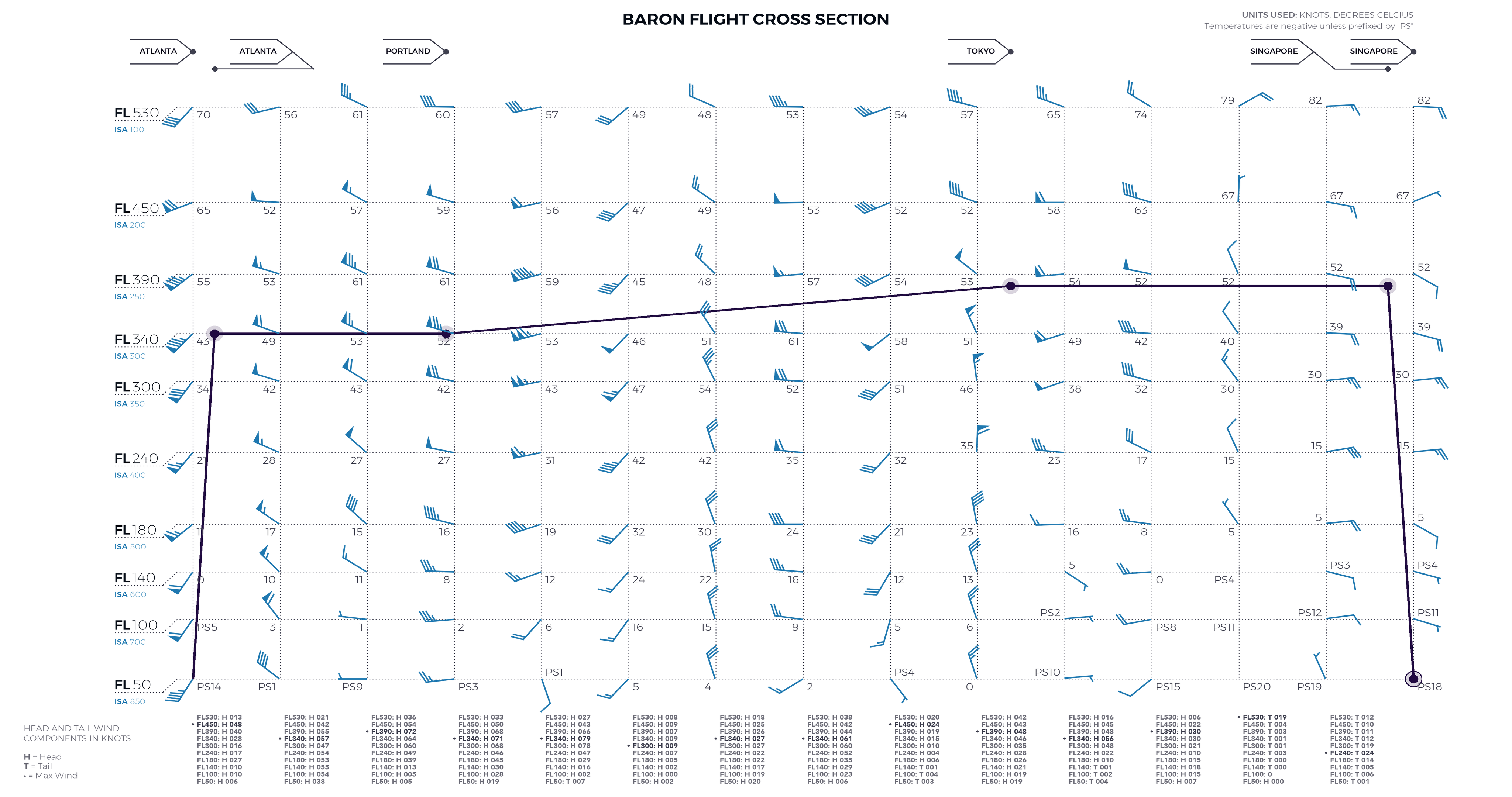
An exemplary cross-section diagram will include wind speed, wind direction, temperature, turbulence, and icing conditions along a user-defined flight path.
Derived Products Can Fill Gaps
Let’s face it. Radar data is unavailable in all parts of the world, especially over oceans. Not every continent or country has the same quality of observational weather data. Satellite technology makes it possible to fill these gaps with remote-sensing derivations.
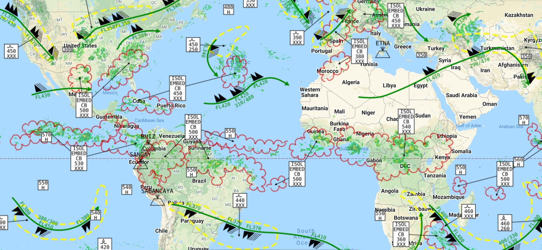
Remote sensing techniques have advanced where lightning can be detected anywhere, and precipitation intensity can be calculated based on cloud temperatures. These simulations are helpful in parts of the world inaccessible by land-based radar or observational networks.
Use Model Data at Many Levels
Forecast models can provide early detection of potential trouble spots aloft. The key is accounting for more than one dataset at a particular flight level. Then, various mapping methods are used to display the data other than just blobs of colors.

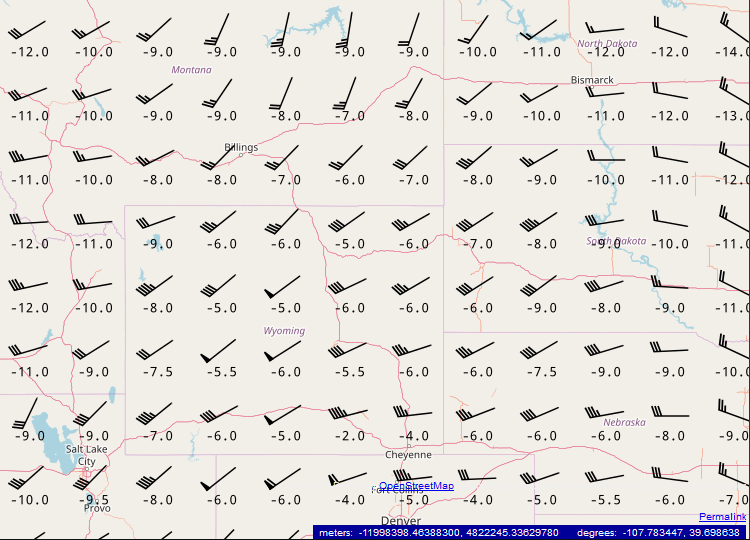 Temperatures and winds aloft from a global model can help your team identify possible severe weather or icing threats several days in advance. This can only be done with a product that merges labels, icons, and colors over a grid.
Forecast Flight Rules with Precision
Most flight delays originate from poor weather conditions at takeoff or landing. Knowing where the trouble spots are ahead of time can help pilots make better decisions. It’s nearly impossible to account for all weather elements that could impact the terminals at once, much less 24 to 48 hours in the future, unless you have a model that can do that for you.
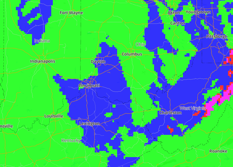
Observational visual (VFR) and instrumental flight rules (IFR) often don’t tell the whole story, as they are limited to a Meteorological Terminal Air Report (METAR) that typically only applies to the area five miles from an airport. High-resolution short-term forecast models process the data necessary to predict the movement of adverse conditions over time toward or away from a destination. So, choose a vendor that does this heavy lifting for you.
The Baron Weather API provides an easy, efficient way for flight tracking and planning services developers to integrate high-quality aviation weather data. Powered by AWS and featuring a RESTful architecture, the Baron Weather API is a customizable and reliable data feed that scales to the size of any organization.
Baron offers over 200 meteorological data products, including more than 60 Baron exclusives. Below are just a few global data products designed to protect pilots, passengers, cargo, and your bottom line!
- Significant weather at high- and mid-levels
- Lightning strikes and lightning heat map
- Satellite-derived radar
- Forecast flight rules
- METARs, SIGMETs, TAFs, and NOTAMs
- Winds and temps aloft forecast
The more you know, and the sooner you know it, the better your flight planning decisions will be. If you need a reliable, superior weather data package and want to customize it for your purpose, we’re here to help.
