It will be a race against time that likely determines how active this year's hurricane season will be.
Forecasters say an El Niño could dampen tropical activity this fall but are unsure how soon that will occur. And the waters are already sizzling, ready to fuel any storms that form.
Regardless of the forecast, residents and business owners in hurricane-prone areas are encouraged to prepare the same every year. The official start of the Atlantic hurricane season is June 1.
The 2023 Hurricane Season Forecast
The National Oceanic and Atmospheric Administration (NOAA) released its first 2023 hurricane season forecast Thursday morning, which calls for "near-normal" activity across the Atlantic Ocean, Caribbean Sea, and Gulf of Mexico. NOAA predicts 12 to 17 named storms, of which 5 to 9 could become hurricanes, including 1 to 4 major hurricanes (with winds 111 mph or higher). Their numbers reflect relatively equal chances of above- and below-normal tropical activity, due to what they call "competing factors".
Forecasters from Colorado State's Atmospheric Science Department issued their forecast in mid-April, predicting a slightly below-average season for the Atlantic basin. They expect overall activity to be roughly 80% of the 30-year average, also citing El Niño's development as a primary factor. However, a "wide range of solutions" was noted by the scientists, and a "well-above average" season was still a possibility.
Why This Season is More Uncertain than Most
An El Niño is declared when a warm spell is observed for three successive months in the equatorial waters of the Pacific Ocean. This phenomenon is one of the greatest influencers of global weather patterns known to man. And research has shown it has strong connections to the quantity and magnitude of tropical cyclones in the Atlantic.
NOAA issued an El Niño Watch on May 11, stating that El Niño conditions were likely to form within a couple of months and that there was a 90% chance it would persist through the upcoming winter. This pattern typically results in stronger upper-level westerly winds across the Caribbean and tropical Atlantic, which can tear apart hurricanes as they try to form.
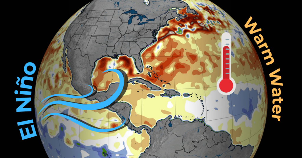
Warm water is essentially what fuels powerful hurricanes. In contrast to the potentially dampening effects of El Niño, sea surface temperatures across much of the eastern and central Atlantic are already well above normal. This makes the uncertainty in the onset and strength of El Niño a critical factor in the 2023 seasonal outlook. If the atmospheric influences of El Niño are later or weaker than expected, the potential exists for an active hurricane season.
Don't Fall for the Numbers
Meteorologists and emergency managers often use the phrase "it only takes one" to dissuade the public from basing preparation on prior storm experience or pre-season forecasts. The same could be said for business owners and insurers: It 'only takes one' bad storm to put you out of business or blow your claims budget.
While preseason hurricane forecasts can provide valuable high-level insights, there are many pitfalls to relying on them for critical business decisions.
However, making the right decision at the wrong time could be costly. So we built a guide, targeted to hurricane response decision-makers!
The next hurricane to respond to is not a matter of if but when. Focusing less on a 6-month forecast and more on impact-specific vulnerabilities can better position your resources for the unexpected.
Investments in smarter monitoring tools for weather perils can enable you to accurately track a storm's growth or decay closer to landfall. And knowing when to pull the trigger on a response requires precise data, actionable insights, and expert analysis.
We have experts that can empower you to make better decisions!
