Hurricane Helene was a powerful storm that highlights the vital role of timely, accurate weather data in emergency response. While tropical systems are often associated with coastal impacts, Helene served as a stark reminder that severe weather can extend hundreds of miles inland. This was particularly evident in the western Carolinas, where emergency response agencies relied on Baron Weather solutions, including Baron Threat Net and Baron’s high-resolution radar, to make crucial decisions to safeguard lives and property.
Emergency Response in Action
In the days leading up to Helene’s landfall, the western Carolinas, northeast Georgia, and eastern Tennessee experienced a significant precursor rain event, saturating the ground with 10 to 15 inches of rainfall. This heightened the flood risk well before Helene even arrived. The focus quickly shifted to flood mitigation. Using Baron Threat Net’s Total and Forecast Rain Accumulations, emergency responders had critical insights to identify high-risk areas, determine shelter locations, and issue timely alerts through the Integrated Public Alert and Warning System (IPAWS) to warn residents of rising river levels.
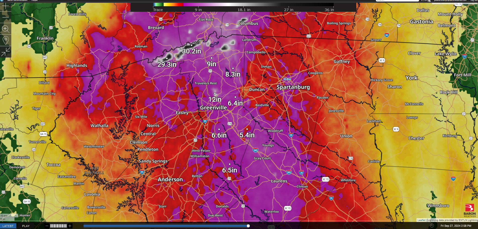
As Helene moved in, Baron’s Flash Flood Risk tool pinpointed the most vulnerable areas, helping officials deploy resources where they were needed most. After Helene, the Saluda River crested at a record 20.23 feet, well beyond the major flood stage.
Beyond operational strategies, the integration of advanced weather intelligence into emergency management was essential for both preparedness and public safety. Predictive weather technology enabled faster, data-driven decision-making, helping to reduce risks and enhance response efforts in the face of extreme weather.
The Impact of an Inland Track
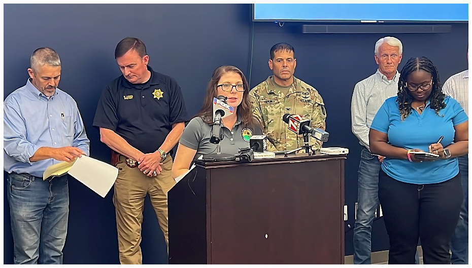
As the Emergency Management Director for Greenville County, I knew the Upstate of South Carolina was no stranger to tropical systems. While much of the state focused on coastal storms, my biggest concern was always Gulf-originating storms. These often placed us in the worst quadrant of a storm, bringing strong winds, torrential rain, and a heightened tornado threat. Initially, if Helene had followed the center of the NHC forecast cone, it would have tracked over Atlanta. Instead, it moved closer to the Upstate, increasing the severity of its impacts.
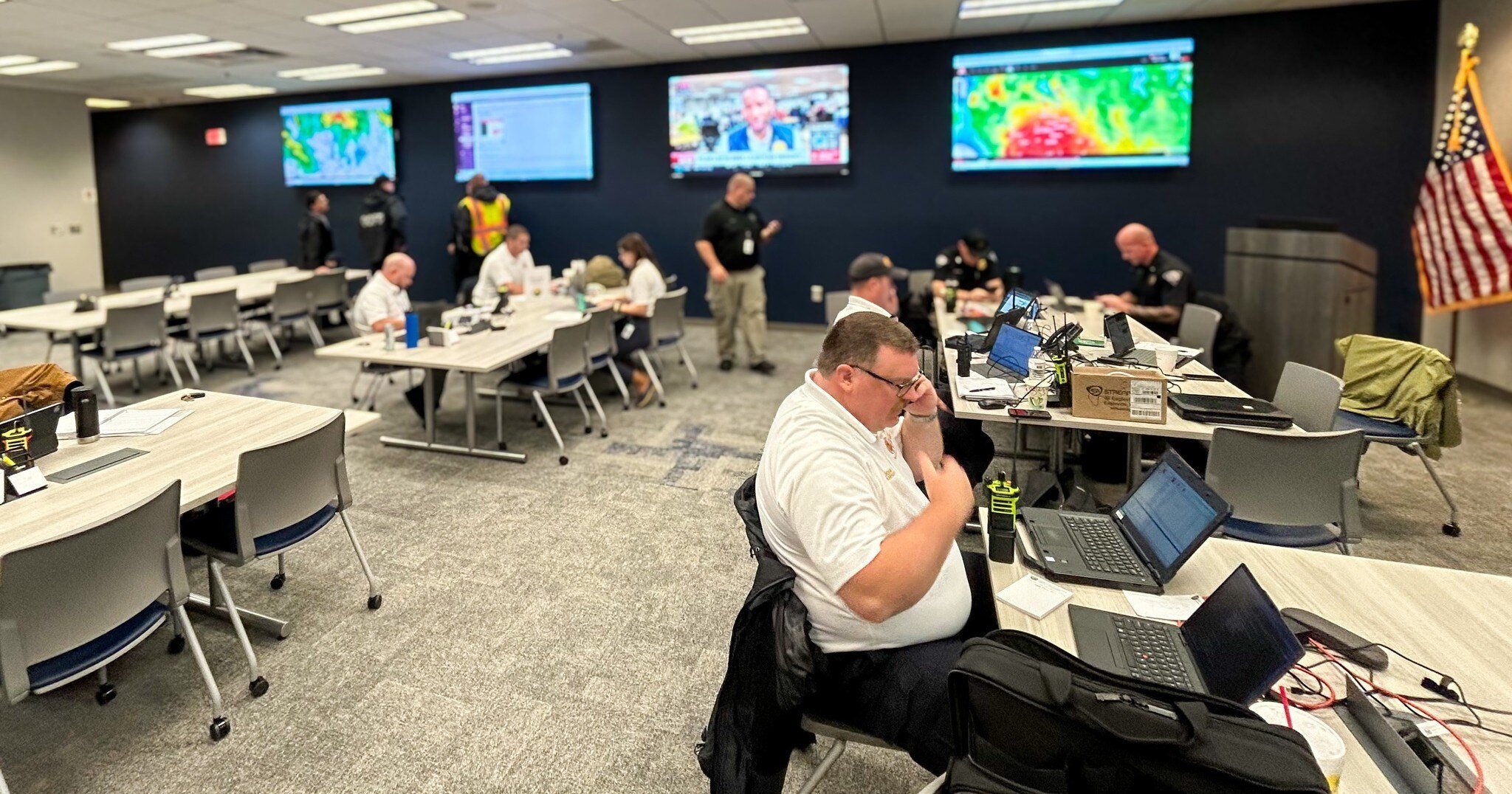
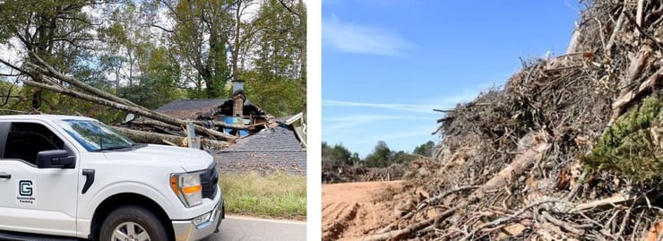
By the time Helene intensified into a Category 4 storm, we had activated the Emergency Operations Center (EOC) and were in full preparation mode. On the day of landfall, the already saturated ground made falling trees a major hazard, forcing us to suspend emergency response operations. The aftermath was staggering with over 1 million cubic yards of debris, 53 structures destroyed, 600 severely damaged, and 16 roads washed out. Tragically, eight lives were lost.
The Power of Localized Weather Data
Access to precise, real-time weather data was crucial in planning and response efforts. Baron Weather Solutions provided emergency managers with actionable insights that enhanced decision-making and public communication.
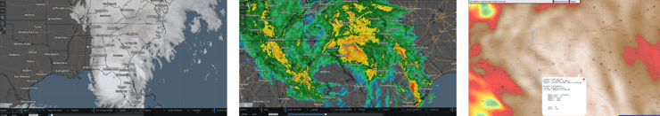
A combination of satellite imagery, doppler radar, and wind analysis proved essential in tracking the storm’s intensity, path, and anticipated impacts. Real-time weather models guided key decisions, such as issuing evacuation notices for flood-prone areas, strategically timing response suspensions until conditions improved, and efficiently allocating resources for search and rescue operations.
Informing Public Safety Decisions
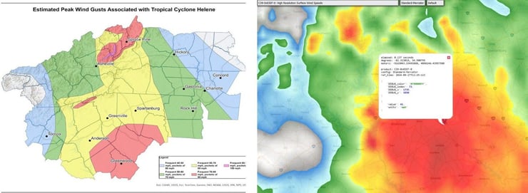
At its peak, 95% of the county lost power, affecting fuel stations, the internet, cell service, and emergency communications. Many jurisdictions have wind thresholds (typically 35–45 mph) that dictate when emergency vehicles and school buses must cease operations. Baron Threat Net’s point query tool enabled real-time monitoring of wind speeds, helping emergency managers determine when to suspend and safely resume emergency response efforts.
The EOC remained active for 16 days as we coordinated recovery efforts with FEMA and response teams from across the country. By leveraging Baron Weather’s cutting-edge tools, emergency management teams were able to make informed, data-driven decisions that enhanced public safety and disaster response efficiency. Helene reinforced the importance of integrating advanced weather technology into emergency operations.

Supporting Emergency Operations
As extreme weather events grow more frequent, the need for real-time, localized weather intelligence has never been greater. Baron Weather solutions continue to provide emergency managers with the data they need to protect lives and infrastructure. Learn how Baron can enhance your emergency response strategy here.
