The early outlook for the 2025 Atlantic hurricane season indicates an active year ahead, with experts forecasting an above-normal number of storms and an increased risk of major hurricane landfalls. On April 3, Senior Research Scientist Dr. Phil Klotzbach presented his team's initial outlook Thursday morning at the National Tropical Weather Conference.

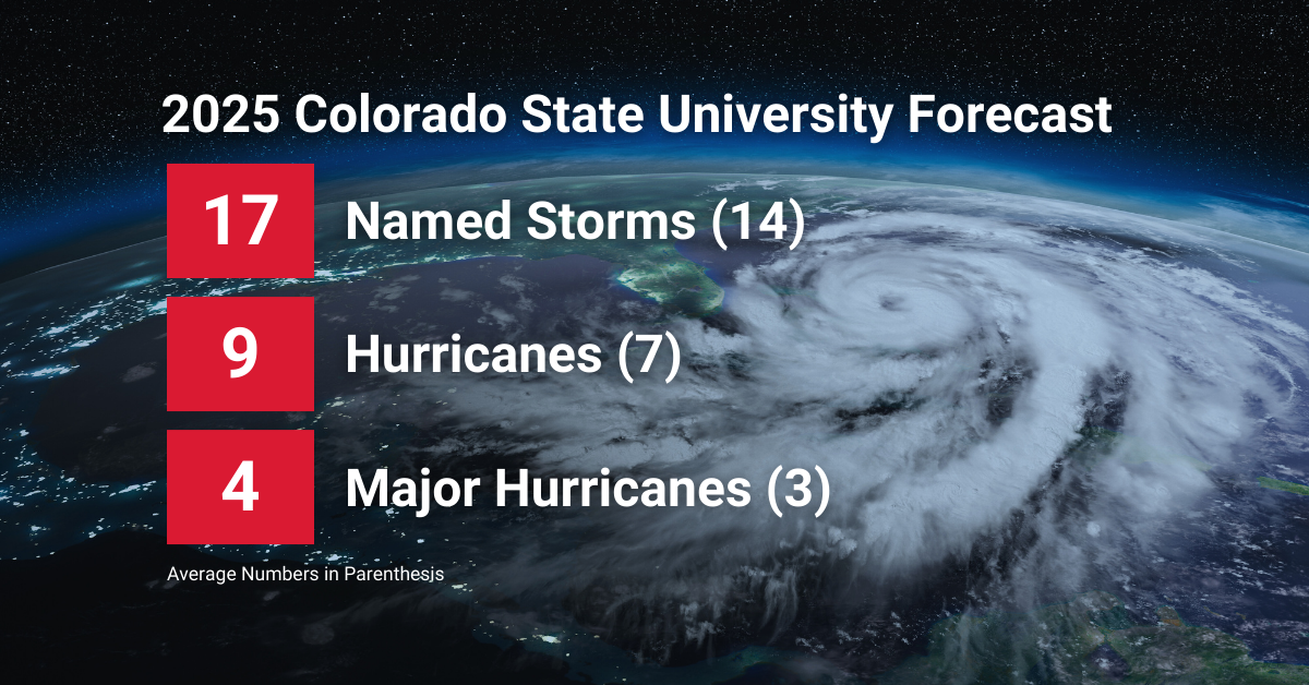
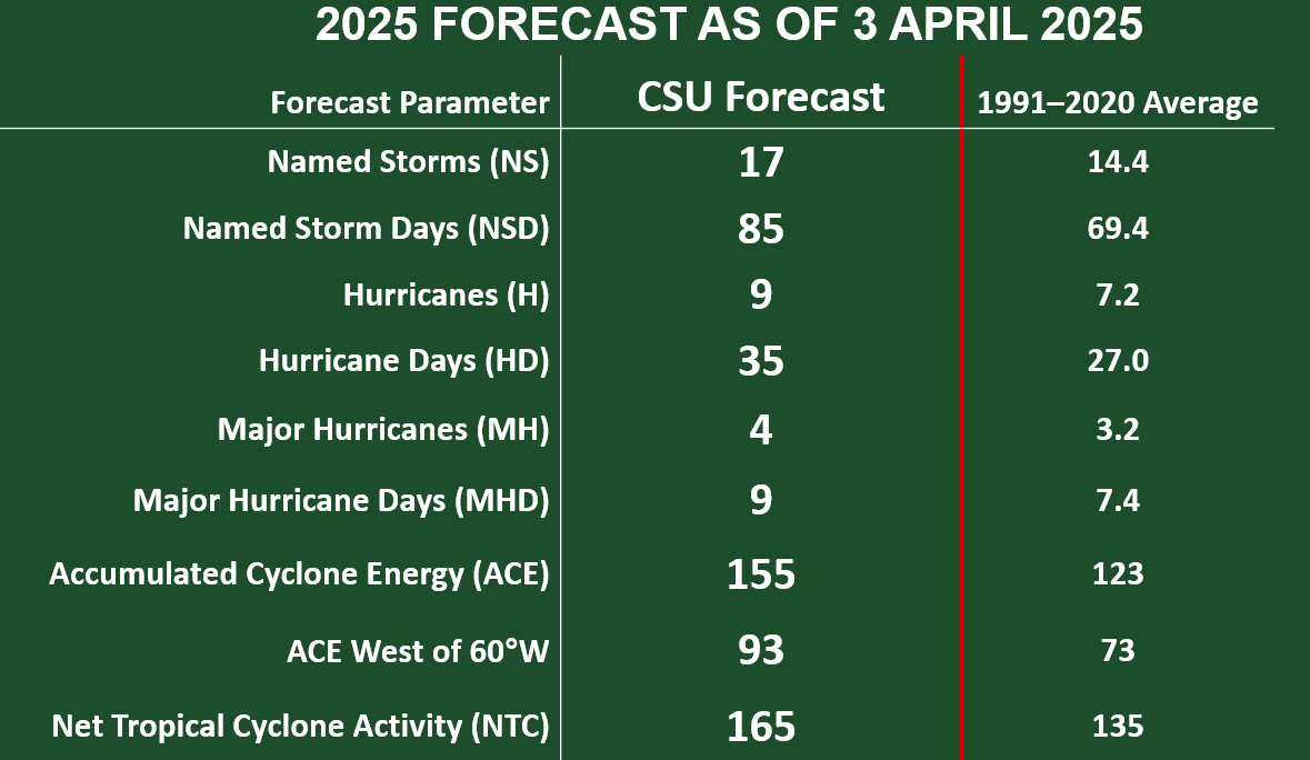
Colorado State University (CSU) predicts a season with 17 named storms, nine hurricanes, and four major hurricanes – all above the 30-year averages of 14, 7, and 3, respectively. The Atlantic hurricane season officially runs from June 1 to November 30.
Key Factors for an Active Season
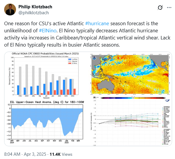
One of the primary reasons for the above-normal hurricane forecast is the unlikelihood of El Niño conditions persisting. Typically, El Niño suppresses hurricane formation in the Atlantic by increasing vertical wind shear, which disrupts storm development. However, with current La Niña conditions likely transitioning to ENSO-neutral in the coming months, the environment may become more favorable for storm formation and intensification.
Additionally, warmer-than-normal sea surface temperatures (SSTs) across much of the Atlantic basin are another major driver of increased activity. The Caribbean and the subtropical eastern Atlantic are currently experiencing above-average temperatures, which historically correlate with more frequent and intense hurricanes. While SSTs are not as high as they were at this time last year, they remain warm enough to contribute to an active season.
Heightened Risk of Major Hurricane Landfalls
The CSU forecast also anticipates an above-average probability of major hurricanes (category 3+) making landfall along the U.S. coastline and in the Caribbean. The warmer SSTs combined with a likely ENSO-neutral pattern create a conducive environment for storms to strengthen.
Major hurricane landfalling probability included in 2025 report:
- Entire U.S. coastline – 51% (average is 43%)
- U.S. East Coast, including the Florida peninsula – 26% (average is 21%)
- Gulf Coast from the Florida panhandle westward to Brownsville, Texas – 33%
(average is 27%) - Caribbean – 56% (average is 47%)
Preparedness Starts Now
No matter how active a season is forecasted to be, one storm can make all the difference. Now is the time for coastal residents, emergency management agencies, and businesses to review their hurricane preparedness plans and ensure they have access to the most reliable weather data available. Learn the steps to take before a storm develops here:
Hurricanes are complex, and the logistics of loss avoidance, mitigation, and response are even more complicated. Smarter weather data and solutions from Baron can empower you to confidently make those decisions in a much shorter amount of time.
When a storm is on the horizon, the insights in this guide will help you assess potential impacts and take strategic action to protect your business or assets.
Stay Informed Ahead of the Storm
For 42 years, Colorado State University has provided seasonal forecasts to help communities and decision-makers anticipate hurricane activity. These forecasts are intended to provide the best possible estimate, not exact predictions. CSU will release updated outlooks on June 11, July 9, and August 6.
Staying informed and prepared in advance is essential as the next hurricane to respond to is not a matter of if but when. Baron Weather is here to help you this hurricane season with the latest technology, solutions, and insights.


