Weather risk is not new.
But for many organizations, investing in better weather data and decision-support tools still doesn’t happen until something “bad enough” forces the conversation.
Lives are lost.
Roads become impassable.
Communities are cut off.
Infrastructure is damaged.
Emergency response is delayed when every minute matters.
The impact is real. The gaps are exposed. And for a moment, the need for change is clear.
In the days that follow, urgency builds. Teams revisit what happened. Conversations start. Leadership leans in. There’s often a shared realization: we need to be more proactive next time.
And then the momentum fades. The news headlines pass. Budgets shift. Priorities move on. And the opportunity to improve gets pushed aside — until the next disaster brings it back to the surface.
This cycle is familiar across state and local agencies, transportation departments, homeland security teams, and emergency management organizations. Not because the risk isn’t understood, but because action is often delayed by competing priorities, budget constraints, and the challenge of securing buy-in before the next disaster strikes.
Why Buy-In Is So Difficult
The people closest to the risk usually aren’t the ones controlling the budget.
GIS professionals, emergency managers, and operations teams often understand the value of weather data immediately. They see the gaps. They feel the limitations. They know where visibility breaks down.
But the decision to invest usually sits higher up – and weather is often just one of many competing priorities.
Those leaders are often balancing aging systems, limited funding, and pressure to justify every new investment.
That’s the argument many internal teams are trying to make: weather data is not a “nice to have.”
For organizations responsible for public safety, infrastructure, transportation, or emergency response, delaying action can be more costly than investing earlier.
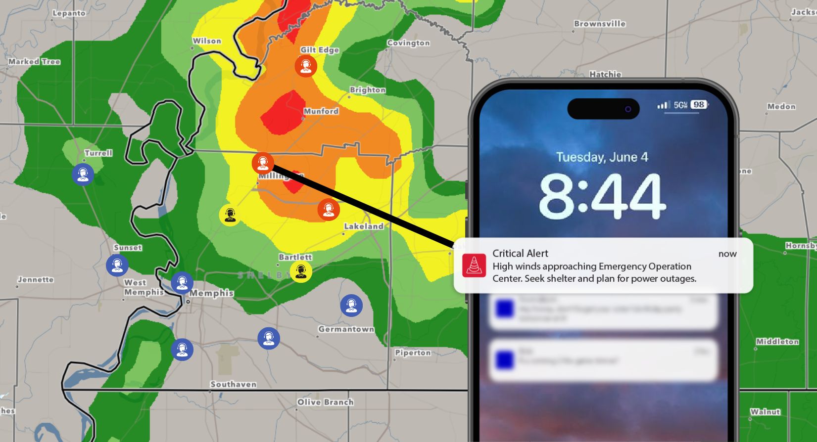
When integrated into the systems teams already use, weather becomes more than a forecast. It becomes real-time operational intelligence that can materially improve decisions, reduce risk, and help protect both communities and operations.
The Technology Is Here, and Many Organizations Are Still Catching Up
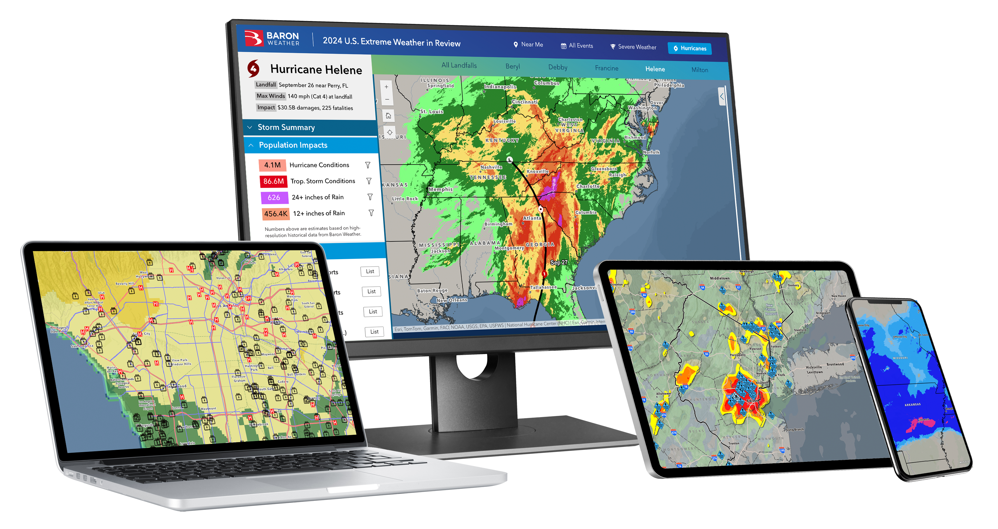
Today, organizations can integrate weather directly into the systems they already use through tools like ArcGIS Online, ArcGIS Enterprise, ArcGIS Velocity, and real-time operational dashboards. When paired with trusted weather intelligence from Baron, those systems become significantly more powerful.
Baron helps organizations move beyond simply viewing the forecast by delivering:
- Real-time, forecast, and historical weather data directly into ArcGIS.
- Faster operational awareness through tools like Baron’s Branded Connector for ArcGIS Velocity.
- Automated alerting and threshold-based monitoring through solutions like Weather Logic.
- Hyper-local severe weather insights through tools like Storm Intel.
- Flexible integration through APIs and ArcGIS-ready weather layers.
In that kind of environment, weather becomes more than something teams monitor on the side. It becomes part of how they assess risk, prioritize assets, communicate internally, and make decisions in real time.
The challenge is not just adoption — it’s modernization. Agencies are still working within legacy systems, relying on manual processes, operating across siloed tools, and navigating technology decisions made 10 to 20 years ago. In many cases, they’re trying to close a much larger gap between what their current systems allow and what today’s operational demands require.
They’re managing today’s weather risks with yesterday’s systems.
How to Move from Awareness to Action
For GIS professionals, emergency managers, and operations teams trying to move this forward internally, the next step is not simply asking for better weather data — it’s changing the conversation.
That means connecting weather investment to the outcomes leaders already care about: stronger situational awareness, faster decision-making, clearer communication, more efficient resource deployment, and reduced operational risk.
The conversation needs to shift from “we need better weather data” to questions like:
- How can we improve visibility across our operations?
- How can we reduce uncertainty before impact?
- How can we make faster, more informed decisions?
- How can we better protect people, infrastructure, and operations?
When teams lack timely, location-specific weather intelligence, they’re often left reacting later than they should, communicating less clearly than they could, or making decisions without the full picture.
The value is not simply having more weather data — it’s having the right weather information, in the right system, at the right time.
That’s what helps organizations answer critical questions faster:
- What's at risk right now?
- Where is impact most likely?
- Which assets or communities need attention first?
- When should action be taken?
When weather is integrated directly into ArcGIS, dashboards, alerts, and operational views, it becomes easier to show its value not as a separate tool, but as part of a more modern and proactive decision-making environment.
The path forward starts by identifying where weather is already creating friction, delay, or uncertainty — and then showing how better visibility and automation could improve those decisions before the next event tests the system again.
The Time to Act Is Now
It’s not if, it’s when. Another storm, flood, fire, or high-impact event will put systems, teams, and decisions to the test. The organizations that move from reactive to proactive now will be better positioned to respond with greater visibility, confidence, and readiness when that moment comes.
Talk to our team today about how our weather data, tools, and solutions can help your organization build a more proactive approach across your workflows, systems, and operational goals.
