By the middle of summer, many people have heard “Heat Advisory” so often that the message has lost its meaning.
That was one of the major themes discussed during last month’s International Association of Emergency Managers (IAEM) Weather Caucus meeting, where emergency managers, meteorologists, and public health partners explored how the public interprets heat messaging — and why traditional terminology alone may not always drive action.
Research discussed during the meeting showed many participants viewed a “Heat Advisory” as informational rather than urgent. Others assumed the messaging only applied to vulnerable populations or people with preexisting health conditions.
At the same time, participants consistently wanted more specific, actionable information, including:
- How hot it will actually feel
- When conditions will be most dangerous
- How long the heat will last
- What actions they should take during that time


In many ways, this reflects how people increasingly consume information today. Whether it’s weather, traffic, or travel delays, people expect clear guidance that helps them make quick decisions without having to interpret technical terminology on their own.
For emergency managers, school districts, and outside workers, this creates a growing challenge of translating weather data into actionable decision support that helps protect people, infrastructure, and operations before impacts escalate.
Moving Beyond the Forecast
Extreme heat is far more complex than a single air temperature value.
Humidity, overnight temperatures, duration, urban heat retention, and even road and surface temperatures can all influence impacts. Conditions like high wet bulb globe temperatures — where heat and humidity combine to reduce the body’s ability to cool itself — can quickly become dangerous, even for healthy individuals.

That’s why organizations increasingly need more than a traditional forecast or static heat headline.
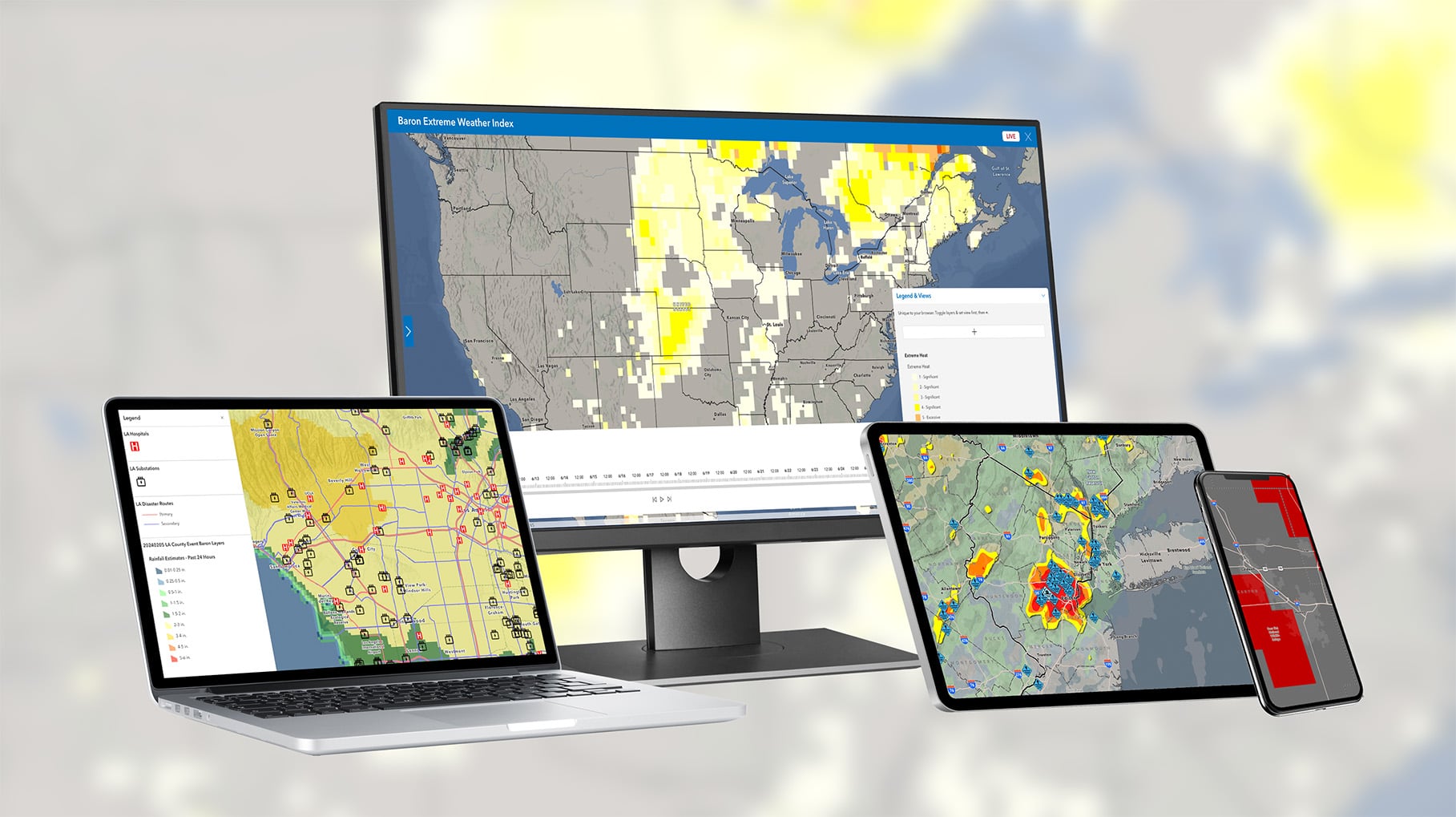
Solutions like Baron’s Weather Logic and ArcGIS Weather Layers help organizations move beyond simply monitoring temperatures by combining weather intelligence with operational awareness and customizable alerting.
For example, agencies can:
- Set alerts based on their thresholds, making it customizable to their operations and community
- Monitor real-time conditions alongside cooling centers, infrastructure, outdoor venues, and response assets
- Visualize where extreme heat overlaps with vulnerable communities or field operations
- Share situational awareness across departments and EOCs
Organizations are also increasingly leveraging higher-impact weather intelligence beyond traditional forecasts, including:
- Wet bulb globe and “feels-like” temperatures
- Road and surface temperature monitoring
- Overnight recovery conditions
- Duration-based heat stress
- Impact-focused datasets like Baron’s Extreme Weather Index (EWI)
Within GIS environments, organizations can integrate real-time weather intelligence directly into dashboards and operational maps, helping teams quickly understand where impacts may occur and when conditions may escalate.
Preparing for the Summer Ahead
As extreme heat events become more frequent and impactful, organizations need more than broad heat alerts and static forecasts. They need actionable weather intelligence that helps teams understand when conditions may become dangerous, where impacts are most likely, and what operational decisions need to happen before situations escalate.
Connect with Baron Weather to see how real-time weather intelligence and customizable alerts can help your team prepare for, monitor, and respond to extreme heat this summer.
