Destructive floodwaters again struck the Texas Hill Country this month, nearly a year after the catastrophic July 2025 flash floods in the same watershed.
The recurrence of these two events might seem like a coincidence, but the geology and climatology behind them say otherwise. And while the risk hasn’t changed, the response to it certainly has.
A Landscape Where Minutes Mean Everything
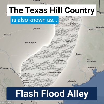
This part of Texas is known as Flash Flood Alley. It’s an area running through the middle of the state, from Waco south to Uvalde, along a band of fault lines and steep hills. In Flash Flood Alley, intense Gulf moisture transport meets thin limestone soils and steep landscapes.
The combination of moisture and this sparse, rocky ground leads to rain that doesn’t soak in and to runoff that flows quickly into the river valleys below. Because the ground cannot absorb the volume, rivers in this region can overflow their banks in minutes! In an environment where this transition happens fast, every second of warning time is critical.
Why the Rain Wouldn't Move
Although Central Texas's geography makes this corridor vulnerable to flooding, it doesn't explain why extreme rainfall occurred in the same month in two consecutive years. Both flood events had the same cause: a mesoscale convective vortex (MCV). An MCV is a small, self-sustaining area of low pressure that forms after heavy rain has already begun.
In late summer, upper-level steering winds across Texas often weaken and become stagnant. Without a strong atmospheric current to push them along, these MCVs can become nearly stationary, triggering new thunderstorms over the same area for hours or even days. As long as a low-level jet—a fast-moving ribbon of air—continues to pull Gulf moisture into the storm, the cycle continues.
In 2025, this setup was combined with the remnants of Tropical Storm Barry. In 2026, the MCV and the moisture from the low-level jet were enough to produce extreme rainfall rates on their own, even without a tropical system present.
A Similar Pattern, Nearly a Century Apart
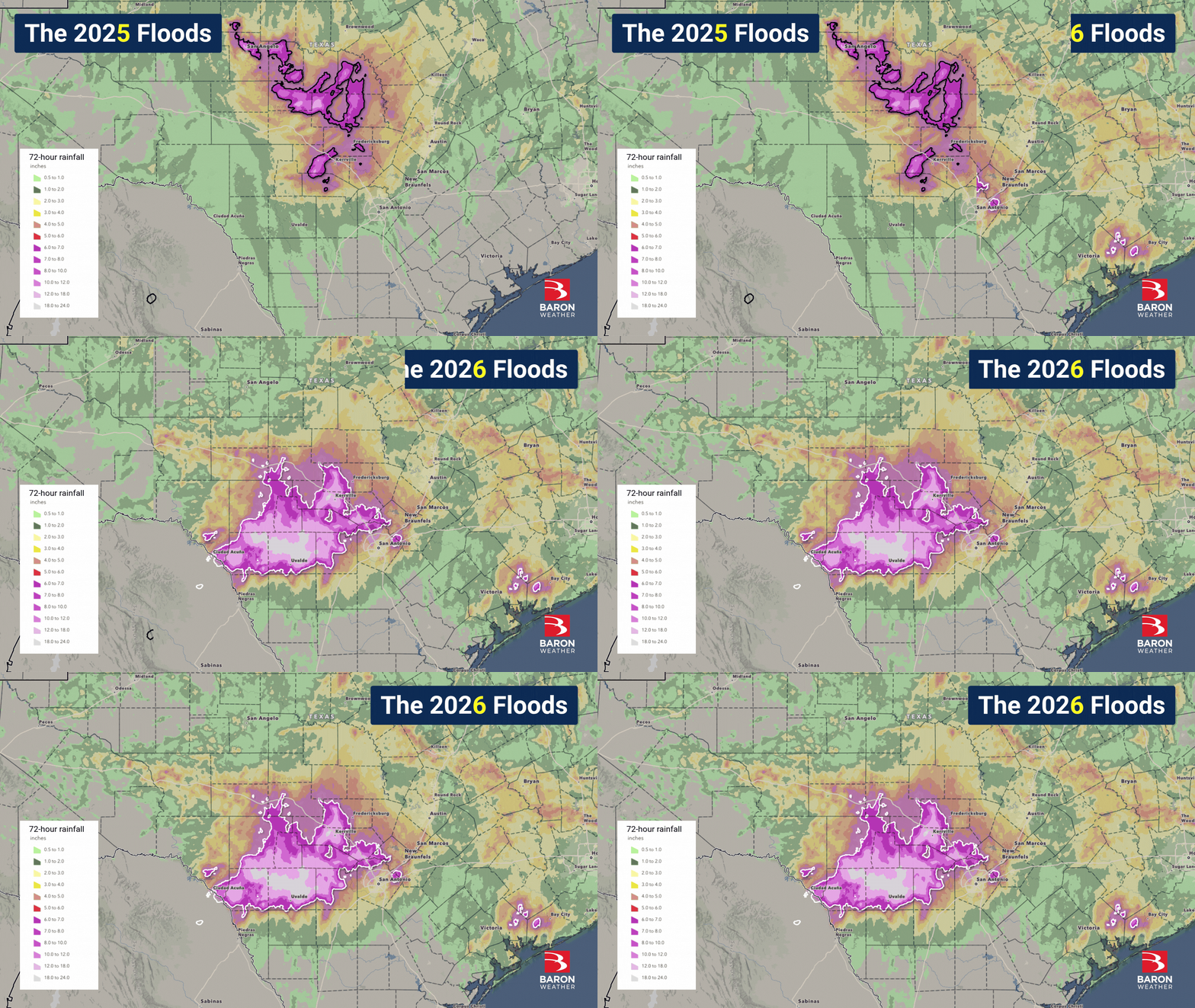
While the atmospheric mechanics of an MCV can seem like a freak occurrence, the historical record shows that these patterns are an inherent part of the Hill Country cycle. In July 2025, a significant rainfall event caused the Guadalupe River to rise over its banks with minimal warning. This July, a much larger portion of the Hill Country experienced torrential rains, and the Guadalupe rose more than 30 feet in just three hours. Over several days, rainfall totals reached up to 20 inches in Kerrville and up to 30 inches near Uvalde.
This was not the first time the river system flooded in consecutive years. U.S. Geological Survey records show that the San Antonio River, part of the same basin as the Guadalupe, reached major flood stage in June 1935 and again in 1936. Back-to-back catastrophic floods in the same river system are rare, but they are not unprecedented. For nearly a century, the region’s vulnerability has remained constant, even as the tools for managing that risk have lagged behind the realities of the landscape.
The Difference in Better Response
Ninety years of geographic vulnerability haven't changed, but our capacity to respond has. This year, new flood sirens and mobile alerts provided critical lead time along the Guadalupe. Local officials credited these systems and updated safety procedures at riverside properties with accelerating the evacuation process. Even with a much larger storm footprint than in 20255, the state confirmed only two deaths, a dramatic reduction made possible by a proactive infrastructure.
The 2026 response extended well beyond previous disaster zones. New warning systems in Ingram, Kerr, and Kendall counties—areas that lacked this infrastructure just one year ago—proved to be an enormous improvement. With 28 additional counties now eligible for flood warning funding, the lessons learned on the Guadalupe are already shaping a more resilient future for emergency managers across Texas.
The success on the Guadalupe is more than just a local victory; it is a scalable blueprint for weather-resilient infrastructure. By integrating real-time monitoring, advanced analytics, and automated warning systems, we are proving that information is the only tool capable of saving time in high-risk environments. This year’s response shows that while we cannot change the geology of a flood-prone landscape, we can apply lessons from past events to improve outcomes. Whether in Flash Flood Alley or any other vulnerable region, the goal remains the same: using modern data systems to ensure that the next storm meets a response that is ready for it.
Sources
-
Texas Water Resources Institute. (2016). Do You Live in Flash Flood Alley? txH2O. https://twri.tamu.edu/blog/do-you-live-in-flash-flood-alley/
-
CBS Austin. (2026). 7 Flash Flood Emergencies Issued as Hill Country Sees 10-15 Inches and Major Rivers Rise. https://cbsaustin.com/news/local/7-flash-flood-emergencies-issued-as-hill-country-sees-10-15-inches-and-major-rivers-rise
-
U.S. Geological Survey. Guadalupe Rv at Comfort, TX (USGS-08167000). USGS Water Data for the Nation. https://waterdata.usgs.gov/monitoring-location/USGS-08167000/
-
Dalrymple, T., et al. (1937). Major Texas Floods of 1936. Water-Supply Paper 816. U.S. Geological Survey. https://pubs.usgs.gov/wsp/0816/report.pdf
-
Martinez, A., Foxhall, E., & Ashby, E. (2026). Key differences spared Texas lives in second straight July flood. The Texas Tribune. https://www.texastribune.org/2026/07/17/texas-south-central-july-floods-lives-saved/
-
Keller, C.L., & Boone, R. (2026). Texas Hill Country floods test new warning systems after last year's deadly disaster. Associated Press via PBS News. https://www.pbs.org/newshour/nation/texas-hill-country-floods-test-new-warning-systems-after-last-years-deadly-disaster