Flash floods are among the deadliest weather hazards on Earth. According to the World Meteorological Organization, they account for nearly 85% of all flood-related fatalities worldwide and more than $50 billion in annual economic losses every year. Despite advances in weather technology, flash flooding remains one of the most difficult threats for forecasters to warn against in time. Not because we can't see it coming, but because we often can't act fast enough when it does.
The problem isn't awareness. It's time.
Most agencies define a flash flood as flooding that occurs within six hours of a rainfall event. In practice, many events unfold far more rapidly, leaving forecasters with a shrinking window to warn communities and coordinate emergency responses. High-resolution weather prediction models can identify approximate areas of risk, but precise location and timing often remain uncertain until conditions are already deteriorating. By the time a full model cycle completes, the opportunity to issue a timely, life-saving warning may already have passed. Traditional modeling approaches simply weren't built for that reality.
That is the operational gap Baron Flood Finder was designed to fill.
Introducing Flood Finder
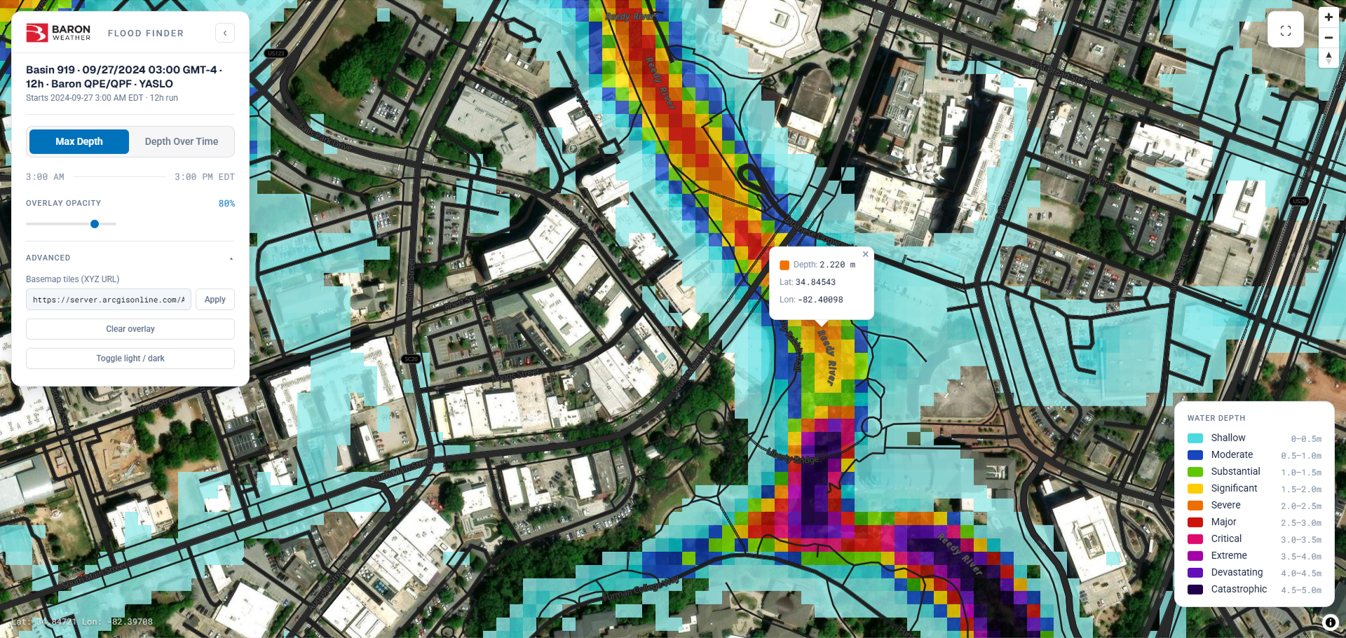
Flood Finder is an AI-powered flash flood prediction solution that couples local weather radar with Baron's weather prediction model to generate actionable flood impact guidance generally in 5 to 10 minutes, on demand. The guidance is detailed enough to identify which basin, community, and road are at risk, not just which county or province. Flood Finder shows how water depth and momentum change over time, capturing not just where flooding occurs but how deep the water gets, how fast it moves, and which direction it flows.
Built around the natural structure of water basins, Flood Finder is designed specifically for the speed demands of operational forecasting. The system uses high-resolution Quantitative Precipitation Forecasts (QPF) to reveal developing threats and can ingest radar-derived Quantitative Precipitation Estimates (QPE) to add recent rainfall accumulations and deliver the most accurate real-time results. Forecasters receive a clear, current picture of flood risk in near real time without waiting for a scheduled model run.
How Flood Finder Deploys
The AI-driven Flood Finder is recommended to run with real-time Quantitative Precipitation Estimates (QPE) from radar networks, where available, or a local C-band or S-band radar, which delivers the most accurate real-time results. A Baron radar, including the new solid-state Baron Fortress, adds new, location-specific rainfall data every 10 to 15 minutes, giving the model fresh decision points as the event unfolds. The closer the radar is to the target area, the sharper and more reliable the guidance. A Baron high-resolution numerical weather prediction (NWP) model supplies Quantitative Precipitation Forecasts (QPF) of developing threats. Flood Finder can run on QPE, QPF, or both together. The results are rapidly generated, depicting the impact as fine as 10 meters anywhere in the world. Forecasters initiate a model run on demand, with results generally ready in 5 to 10 minutes, and can re-run it as often as conditions evolve.
Built for the Moment
What sets Flood Finder apart is its ability to run during a live flood event. A model result that arrives after a flood has peaked is no longer actionable. Flood Finder delivers intelligence for the moment before that, when there is still time to act.
Getting results is as simple as the push of a button. Select your target basin, initiate a run, and street-level flood guidance is ready in minutes with no complex processes to manage and no waiting on scheduled cycles.

The resolution of the output matters just as much as the speed. Flood Finder produces guidance precise enough to identify which specific roads, watersheds, and assets are at risk, not broad area estimates that leave decision-makers guessing. Baron brings together the radar, numerical weather prediction, and AI flood intelligence into one seamless solution, so organizations get the intelligence they need. Fast, high-resolution guidance delivered while an event is unfolding gives decision-makers what they need to act, and that can save lives.
Proven Against Real-World Events
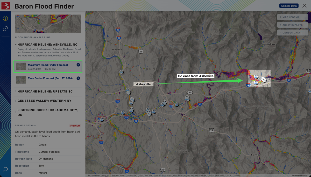
Flood Finder has been tested against recent high-impact events, including the 2024 Dubai flooding, Hurricane Helene, the 2025 Kerr County, Texas flash floods, and Tropical Cyclone Alfred. Here’s how its guidance compared with what happened on the ground.
Swannanoa, North Carolina
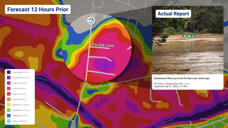
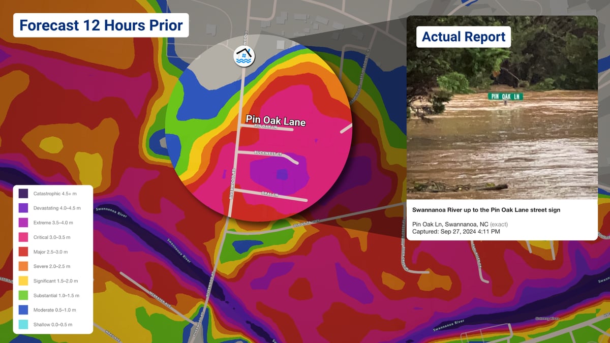
During Hurricane Helene, Flood Finder’s forecast showed severe flooding on Pin Oak Lane in Swannanoa 12 hours before the Swannanoa River rose to the street sign.


Greenville, South Carolina
Helene brought more than 15 inches of rain to Upstate South Carolina and sent the Reedy River surging through downtown Greenville. At Unity Park, the 9-foot UNITY letters show just how high the water rose. Flood Finder estimated a maximum depth of 1.54 meters (5.0 feet) at the sculpture.
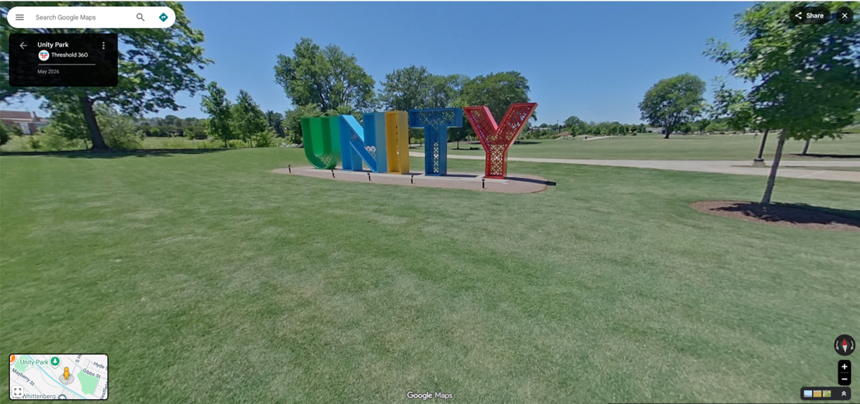
Location: Greenville, SC (Google Street View)
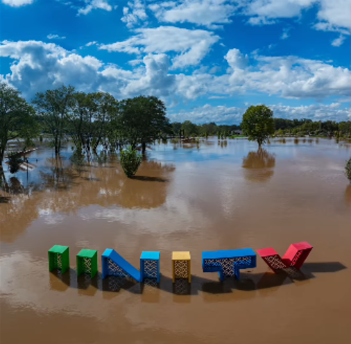
Observed flooding: Photo: Vanzeppelin Aerial
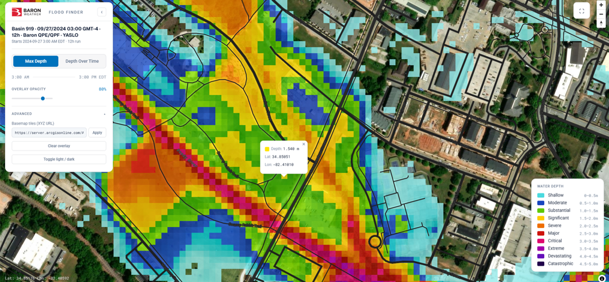
Flood Finder results: Modeled maximum depth: 1.54 m (5.0 ft)
Downtown, along the same river, is a landmark that normally runs as a gentle cascade over the rocks. Flood Finder modeled a maximum depth of 2.22 meters (7.2 feet) at the Falls.
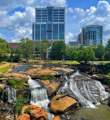
Location: Photo: Jessica Stumpf
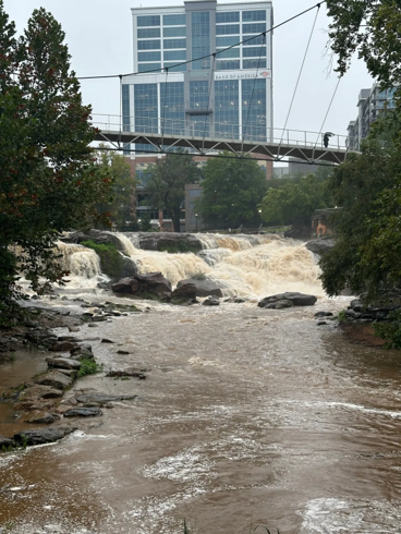
Observed flooding: Video still: Vanzeppelin Aerial
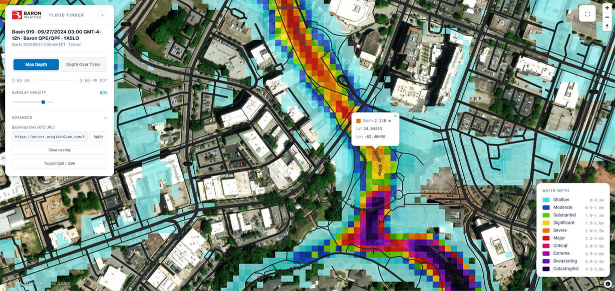
Flood Finder results: Modeled maximum depth: 2.22 m (7.2 ft)
Camp Taum Sauk, Southeast Missouri
On July 9 and 10, 2026, 6 to 11 inches of rain fell overnight across Iron and Reynolds counties, and more than 200 children and staff were airlifted from Camp Taum Sauk. Flood Finder’s reconstruction mapped how floodwater moved through the camp, closely matching aerial photos taken during the morning evacuation.
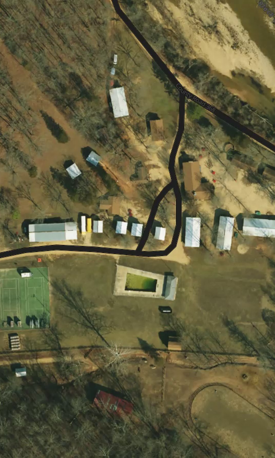
Location: Satellite View: Esri
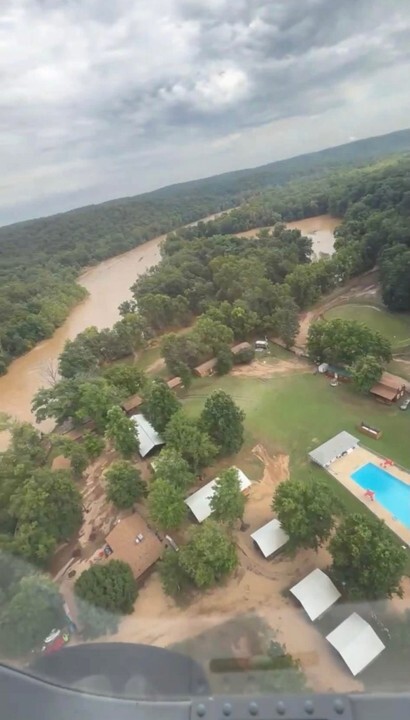
Observed flooding: Photo: Camp Taum Sauk
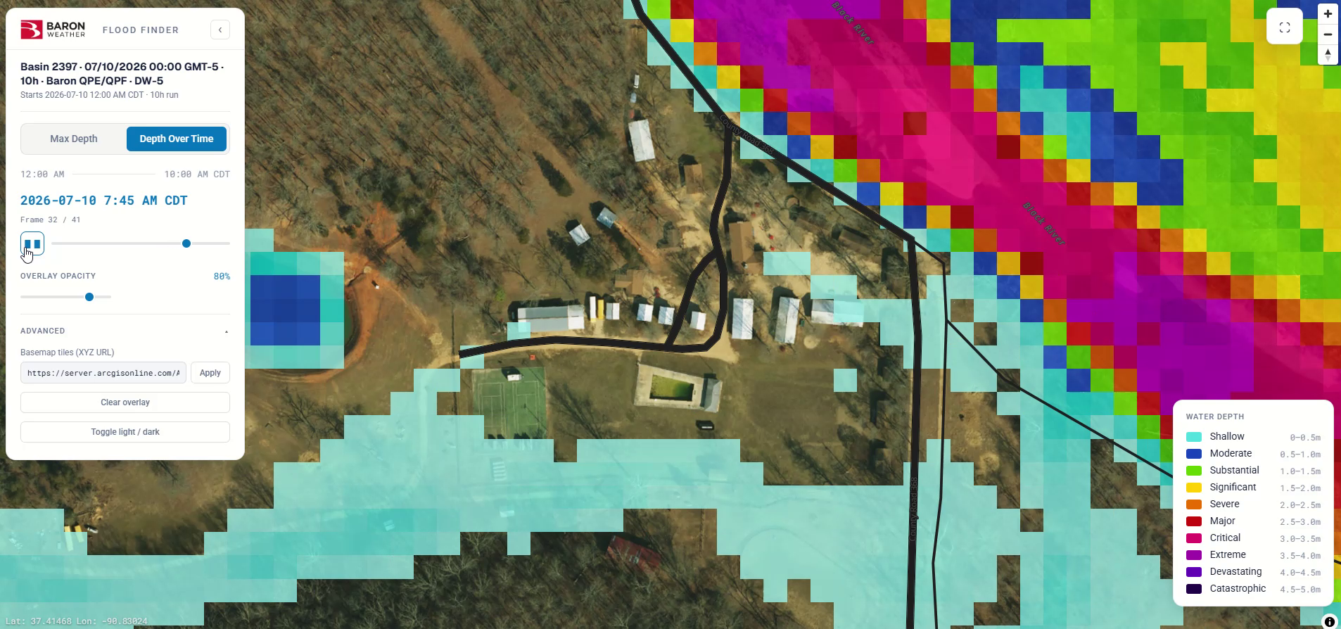
Flood Finder results: Modeled flood depth, 7:45 AM, July 10, 2026
Swain, New York
On March 31, 2026, flash flooding sent muddy water and debris across County Road 24 outside the Sierra Inn. A Baron Flood Finder run mapped flooding along Canaseraga Creek and the NY-70 corridor, with a modeled depth of 2.88 meters (9.4 feet) at the Inn.
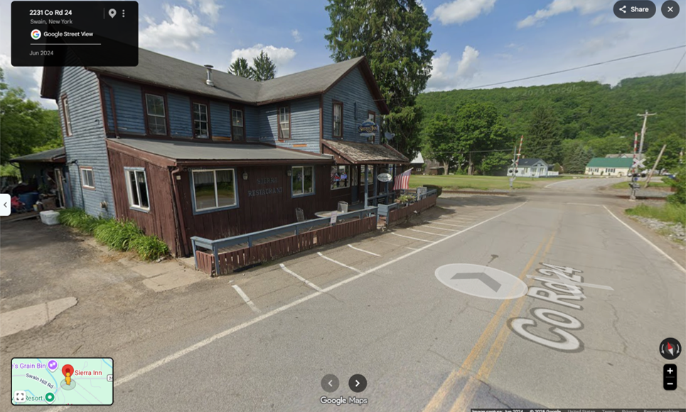
Location: Swain, NY (Google Street View)
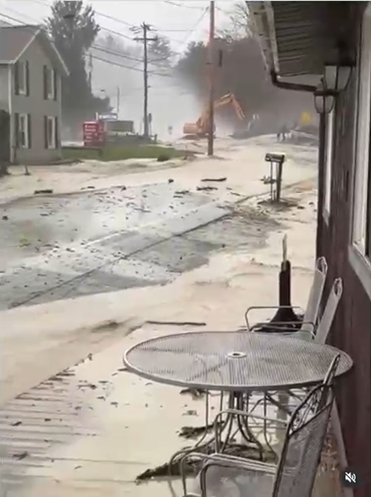
Observed flooding: Video still: @snitileric
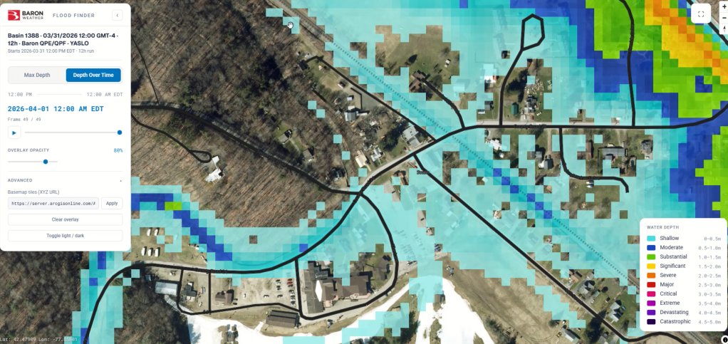
Flood Finder results: Modeled maximum depth: 2.88 m (9.4 ft)
Built for the World
Flash flooding is a global problem. From the river basins of Southeast Asia to the storm-prone corridors of the American South, communities around the world face this threat with varying levels of forecasting infrastructure and resources. Flood Finder was designed with that reality in mind. It’s deployable nearly anywhere on the planet, making advanced flood guidance accessible not just to well-resourced national agencies, but to the government, public, and private organizations who need it most.
Exactly how an organization puts Flood Finder to work varies. Some deploy the full radar-to-guidance package, while others integrate Flood Finder with radar or modeling infrastructure they already have. Results are delivered in open, industry-standard formats such as GeoTIFF and can be integrated into existing operational workflows through an API. Flood Finder serves national meteorological and hydrological agencies, as well as operations teams in emergency management, utilities and energy, transportation and infrastructure, and insurance and risk, each with their own operational needs and deployment scenarios.
Users are meteorologists, forecasters, and operational staff responsible for ensuring that the appropriate advance notice and actions are taken during threatening flooding situations. By harnessing the power of AI and removing the barriers that have historically limited advanced flood modeling to well-resourced agencies, Baron Weather is working to close the gap between when a flash flood threat develops and when communities receive the warning they need. Because when it comes to flash flooding, minutes don’t just matter. They save lives.
Ready to see Flood Finder in action? Contact our team today to learn more or request a demo.