Stop watching the weather. Start automating your workflow.
Imagine a utility has crews working across several counties. Company policy requires field work to stop whenever lightning is detected within 8 miles of any active job site.
Without automation, someone has to continuously monitor weather conditions, determine when lightning enters that safety radius, and notify field crews. That process takes time, and during rapidly changing weather, every minute matters.
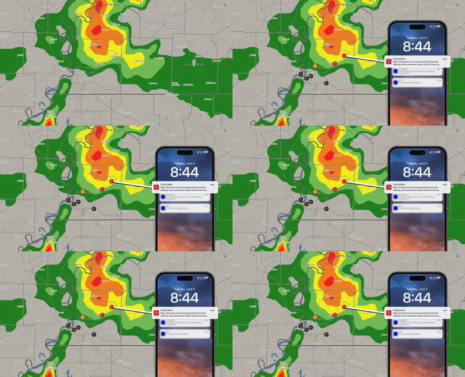
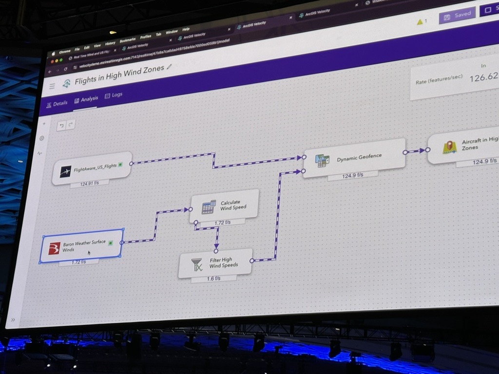
With ArcGIS Velocity and Baron Weather Data, that workflow can be automated. Live weather conditions are continuously monitored against your organization's predefined thresholds, automatically notifying the right people when action is needed.
The same concept applies to countless weather-dependent operations.
Whether you're monitoring flood-prone roads, high winds around critical infrastructure, or severe weather impacting facilities, ArcGIS Velocity and Baron Weather help automate weather monitoring so your teams can focus on making decisions instead of constantly watching weather maps.
Every Organization Defines Weather Differently
No two organizations respond to the weather in the same way.
A transportation agency may monitor flood-prone roadways. An airport may prioritize lightning and visibility. A utility company may focus on wind and lightning near substations or field crews.
Even organizations in the same industry often have different operational thresholds.
A construction company may stop crane operations when forecast wind gusts reach 25 mph, while another continues until winds exceed 35 mph.
The weather is the same.
Your operational thresholds aren't.
That's why weather automation shouldn't rely on predefined rules. With ArcGIS Velocity, organizations define the weather conditions that matter to their operations. Those thresholds can then be monitored around assets, facilities, work crews, service territories, or any geographic area in ArcGIS, allowing automated workflows to align with real-world operations.
When those user-defined thresholds are met, automated workflows can send notifications, update dashboards, trigger downstream systems, or initiate other actions—without someone manually monitoring the weather.
Bringing weather into ArcGIS is the first step toward improving operational awareness. If you're just getting started, read our guide to Weather Data in GIS-Driven Risk Management to learn why integrating weather directly into GIS creates a stronger foundation for decision-making.
Once weather is part of your GIS workflow, the next step is automating it.
Weather Data You Can Automate
The real value isn't simply receiving weather alerts—it's continuously monitoring the weather conditions that matter most to your organization and automatically initiating the next step when those conditions occur.
Whether you're responsible for public safety, critical infrastructure, transportation, or field operations, automation can be tailored to the weather thresholds that matter most to your organization.
Lightning Safety
An outdoor event or emergency management agency may establish a safety buffer around a venue or incident area.
Using Baron Lightning Data, automated workflows can notify staff when lightning enters the designated radius, giving staff more time to respond to changing conditions.
Flash Flood Risk
A transportation agency can monitor Baron Flash Flood Risk around flood-prone roadways instead of relying on rainfall totals alone.
When flood risk exceeds a predefined threshold, teams can be notified to inspect conditions, prepare road closures, or deploy resources before impacts worsen.
High Wind Operations
Construction companies, utilities, and airports often have different wind thresholds based on their operations.
Using Baron Forecast Wind Gusts, organizations can automatically receive notifications when forecast winds exceed their predefined limits, giving teams more time to adjust schedules or secure equipment.
Severe Weather Monitoring
Organizations can also automate monitoring for National Weather Service watches and warnings, Baron Storm Reports, and many other datasets.
Rather than monitoring every weather event, teams receive timely notifications only when conditions impact the locations, assets, or operational thresholds they've defined.
Better Weather Data Drives Better Automation
Automation is only as effective as the data driving it.
The goal isn't simply to automate notifications—it's to automate the right notifications.
That starts with weather data you can trust.
Baron Weather Data delivers high-resolution, continuously updated weather intelligence designed for operational decision-making. Whether it's lightning, forecast wind, Flash Flood Risk, radar, or severe weather alerts, reliable weather data gives automated workflows the confidence to trigger at the right time.
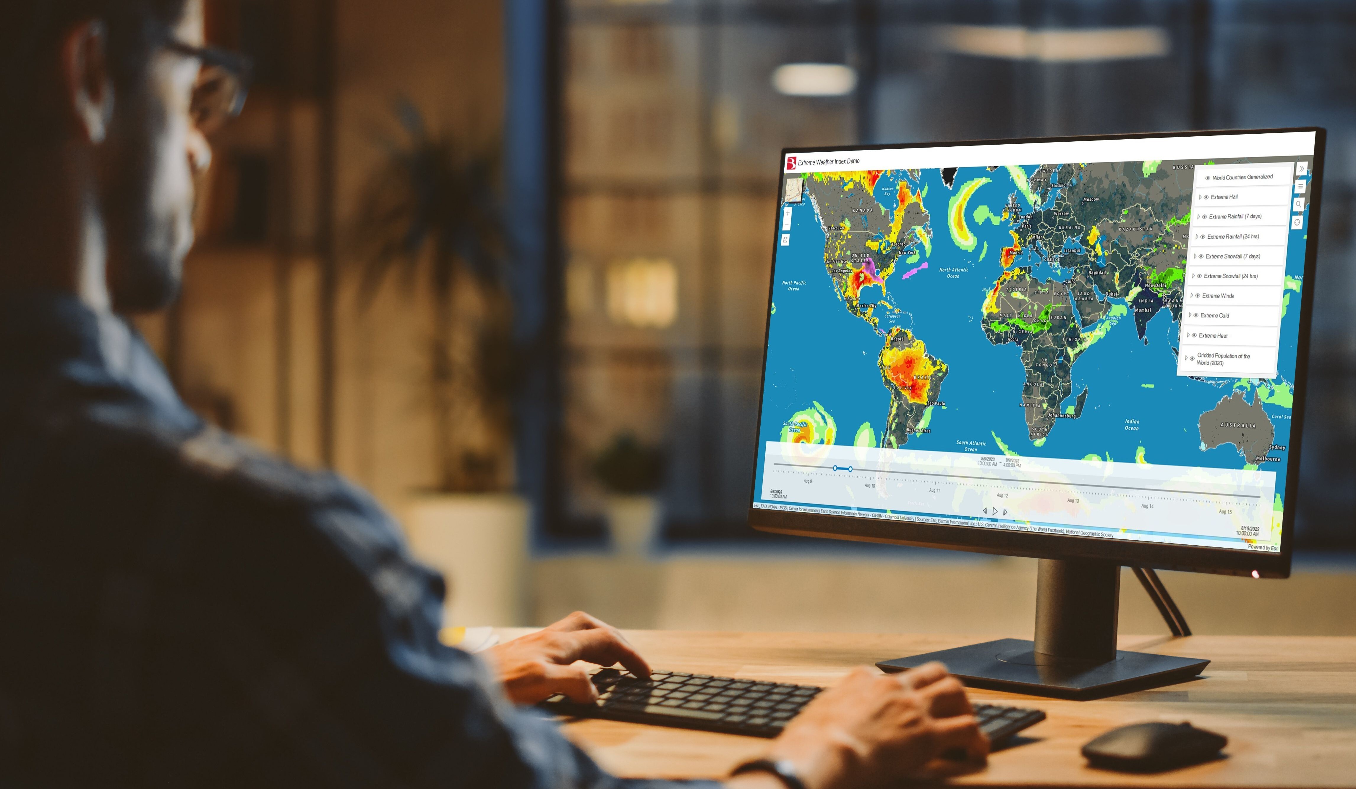
When combined with organization-specific thresholds, teams receive relevant, actionable information instead of unnecessary alerts—helping them respond faster and make better operational decisions.
Automate the Weather That Matters
Organizations already know which weather conditions matter to their operations.
The challenge is monitoring those conditions continuously and ensuring the right people receive the right information at the right time.
By combining Baron Weather Data with ArcGIS Velocity, organizations can automate weather monitoring based on their operational thresholds, helping teams spend less time watching the weather and more time acting on it.
Because when weather intelligence becomes part of your workflow—not another dashboard to monitor—your organization can respond faster, improve consistency, and make more informed operational decisions.
Ready to see how it works? Request a demo and discover how Baron can help automate weather monitoring for your organization.